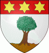
Żebbuġ (Iż-Żebbuġ)
 |
With an area of 7.6 km2, Żebbuġ is the largest local council in Gozo by land area. The word Żebbuġ means "olive trees", a crop for which the village used to be noted, although nowadays very few olive trees remain on the slopes of Żebbuġ. The village is also well known for its fine lacework and for its nearby coastal beauty spots.
The areas around Żebbuġ have been inhabited for millennia. There are Bronze Age remains on Ta' Kuljat hill, and even older remains can be found to the north, close to Qbajjar Bay. Punic tombs were also found at Qbajjar.
Over the following centuries, the area was then inhabited only by a few farmers. A community began to take shape in the 13th century, and eventually a small chapel was built.
In 1643, plans were made to build a fortified city in Marsalforn, to serve as Gozo's capital instead of the ancient Cittadella, but the project was eventually abandoned due to a lack of funds.
The parish of Żebbuġ, which is dedicated to the Assumption of Mary (Santa Marija), was established on 28 April 1688 by bishop Davide Cocco Palmieri. The village's parish church is the oldest one in Gozo, apart from St George's basilica (1678) and the cathedral (1714) in Victoria.
From 1715 onwards, a chain of fortifications were built along the Żebbuġ coastline, especially at Marsalforn. Most of these have been destroyed over the years, with the only surviving vestige being Qolla l-Bajda Battery between Qbajjar and Xwejni Bays.
In 1738, deposits of calcite travertine (referred to locally as alabaster, or, though it is related to neither, as 'onyx marble' on account of its banded appearance when cut) were discovered in a field known as Taċ-Ċaqra or Is-Sagħtrija. The travertine was used to decorate the interior of the parish church of Żebbuġ, as well as in some other churches in Gozo and Malta.
Map - Żebbuġ (Iż-Żebbuġ)
Map
Country - Malta
 |
 |
| Flag of Malta | |
Malta has been inhabited since approximately 5900 BC. Its location in the centre of the Mediterranean has historically given it great strategic importance as a naval base, with a succession of powers having contested and ruled the islands, including the Phoenicians and Carthaginians, Romans, Greeks, Arabs, Normans, Aragonese, Knights of St. John, French, and British, amongst others.
Currency / Language
| ISO | Currency | Symbol | Significant figures |
|---|---|---|---|
| EUR | Euro | € | 2 |
| ISO | Language |
|---|---|
| EN | English language |
| MT | Maltese language |


