Flag of Palau
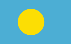
The flag of Palau was adopted on 1 January 1981, when the island group separated from the United Nations Trust Territory. As with the flags of several other Pacific island groups, light blue is the color used to represent the ocean and the nation's place within it. While this puts Palau in common with the Federated States of Micronesia and other neighboring island groups, the disc on the flag (similar to that on Japan's flag) is off-centre like that of the flag of Bangladesh, but in this case the disc represents the moon instead of the sun. The current flag was introduced in 1981 when Palau became a republic.
Previously, the flag of the Trust Territory of the Pacific Islands was flown jointly with the United Nations and American flags. The explanation for the choice of colors is rooted in the history and customs of the Palauan people. The light blue of the field symbolizes the Pacific Ocean, and also represents the transition from foreign domination to self-government. The golden disk, which sits slightly off-center toward the hoist, represents the full moon. The Palauans consider the full moon to be the optimum time for human activity. At this time of the month, celebrations, fishing, sowing, harvesting, tree-felling, and the carving of traditional canoes are carried out. The moon is a symbol of peace, love, and tranquility.
According to the Palauan government website, the flag is a golden-yellow full moon slightly off-centered on a field of sky blue. The width of flag is 13⁄5 of the flag's height, meaning the aspect ratio is 5:8. The moon's diameter is 3⁄5 of the flag's height, its center is placed on the middle of the flag's height and the 7⁄10 part of the flag's height from the hoist side.
National flag
Country - Palau
Warning: getimagesize(/Image/Map/MP1559582.gif): failed to open stream: No such file or directory in /home/mapnlee7/public_html/MAPNALL/article.php on line 532
 |
 |
The country was originally settled approximately 3,000 years ago by migrants from Maritime Southeast Asia. Palau was first drawn on a European map by the German missionary Paul Klein based on a description given by a group of Palauans shipwrecked on the Philippine coast on Samar. Palau islands were made part of the Spanish East Indies in 1885. Following Spain's defeat in the Spanish–American War in 1898, the islands were sold to Germany in 1899 under the terms of the German–Spanish Treaty, where they were administered as part of German New Guinea. After World War I, the islands were made a part of the Japanese-ruled South Seas Mandate by the League of Nations. During World War II, skirmishes, including the major Battle of Peleliu, were fought between American and Japanese troops as part of the Mariana and Palau Islands campaign. Along with other Pacific Islands, Palau was made a part of the United States-governed Trust Territory of the Pacific Islands in 1947. Having voted in a referendum against joining the Federated States of Micronesia in 1978, the islands gained full sovereignty in 1994 under a Compact of Free Association with the United States.