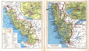
지도 - 할란드 (Halland County)
지도
나라
수도
국제공항
국기
통화
언어
뉴스
세계
유럽
스웨덴
할란드
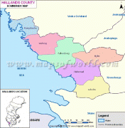
할란드 (Halland County)
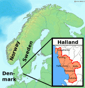
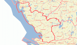
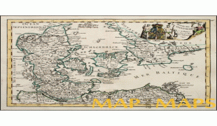
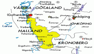
할란드는 스웨덴 남부 예탈란드 지역을 구성하는 지방 가운데 하나로 면적은 4,796km2, 인구는 303,895명(2009년 기준)이다. 북쪽으로는 베스테르예틀란드 지방, 동쪽으로는 스몰란드 지방, 남쪽으로는 스코네 지방과 접하며 서쪽으로는 카테가트 해협과 접한다. 스웨덴 서부 연안에 위치하며 할란드주가 이 지방에 속한다. 지방을 상징하는 꽃은 양골담초, 동물은 연어이다.
* 할란드 관광정보
* 할란드 관광정보
지도 - 할란드 (Halland County)
지도
지도 - 할란드
구글
지도 - 할란드
구글 어스
지도 - 할란드
빙
지도 - 할란드
노키아
지도 - 할란드
오픈스트리트맵
지도 - 할란드
Cohrs_atlas_%C3%B6ve...
4125x3164
upload.wikimedia.org
지도 - 할란드
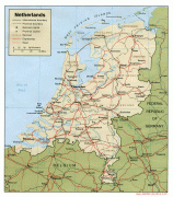
Netherlands-regions-...
1928x2215
wikitravel.org
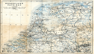
지도 - 할란드
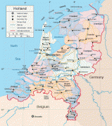
Holland.jpg
2000x1808
www.tourvideos.com
지도 - 할란드
netherlands-map-of-c...
1236x1737
rememberingletters.f...
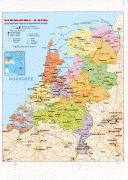
지도 - 할란드
4335214662_39a80eac0...
1131x1695
farm3.staticflickr.c...
지도 - 할란드
map-of-Netherlands-o...
1352x1051
4.bp.blogspot.com
지도 - 할란드
road_map_of_netherla...
1036x1178
www.vidiani.com
지도 - 할란드
denemark-including-h...
900x1200
www.mapandmaps.com
지도 - 할란드
denemark-including-h...
900x1200
www.mapandmaps.com
지도 - 할란드
holland-physical-lar...
794x898
www.europeetravel.co...
지도 - 할란드
LA2-Halland.png
697x717
upload.wikimedia.org
지도 - 할란드
map-level1-south-ken...
803x608
2012.afscme.org
지도 - 할란드
Karta-%25C3%25B6ver-...
740x600
2.bp.blogspot.com
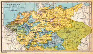
지도 - 할란드
belgium_holland_map....
594x653
www.rgts.co.uk
지도 - 할란드
49e8baa260e7626c3e2f...
600x612
media-cache-ak0.pini...
지도 - 할란드
denemark-including-h...
600x600
www.mapandmaps.com
지도 - 할란드
denemark-including-h...
600x600
www.mapandmaps.com
지도 - 할란드
denemark-including-h...
600x600
www.mapandmaps.com
지도 - 할란드
denemark-including-h...
600x600
www.mapandmaps.com
지도 - 할란드
halland-map.gif
602x566
www.map-of-sweden.co...
1
2
나라 - 스웨덴
스웨덴의 국기
스웨덴 왕국, 약칭 스웨덴은 북유럽의 스칸디나비아 반도의 동반부를 차지하는 입헌 군주국이며 수도는 스톡홀름이다.
지도 - 스웨덴
통화 / 언어
ISO
통화
상징
유효숫자
SEK
스웨덴 크로나
(Swedish krona)
kr
2
ISO
언어
SE
북부 사미어
(Northern Sami)
SV
스웨덴어
(Swedish language)
FI
핀란드어
(Finnish language)
동네 - 나라
노르웨이
핀란드
행정 구역
나라, 스테이트, 지역,...
라홀름시
바르베리시
쿵스바카시
팔켄베리시
할름스타드시
휠테시
도시, 촌락,...
Glommen
언어
Halland
(English)
Halland
(Italiano)
Halland
(Nederlands)
Halland
(Français)
Halland
(Deutsch)
Halland
(Português)
Халланд
(Русский)
Halland
(Polski)
哈蘭
(中文)
Halland
(Svenska)
Halland
(Română)
ハッランド地方
(日本語)
Галланд
(Українська)
Халанд
(Български)
할란드
(한국어)
Halland
(Suomi)
Halland
(Dansk)
Halland
(Türkçe)
Halland
(Eesti keel)
Halland tartomány
(Magyar)
Halland
(Hrvatski)
Χάλαντ
(Ελληνικά)
Halland
(Tiếng Việt)