Agdam Rayon (Aghdam Rayon)
Most of the territory of the district was under the occupation by Armenian forces following the First Nagorno-Karabakh War in the early 1990s. However, as part of the 2020 Nagorno-Karabakh ceasefire agreement which ended the 2020 Nagorno-Karabakh War, the city of Agdam and the surrounding district were returned to Azerbaijani control on 20 November 2020.
There are different opinions about the origin of the name Aghdam. According to some sources, the word "Ağdam" means "white castle" in old Turkish. According to this version, Turkic-speaking tribes living in this region in the distant past built small fortresses mainly to defend themselves. Over time, the meaning of the name of the city changed. In the first half of the 18th century, the founder of the Karabakh khanate, Panahali khan, ordered that a white stone building be built for him in this city. For a long time this building became a kind of icon for the inhabitants of the surrounding villages. In this sense, "Aghdam" means a white house illuminated by the sun's rays. Aghdam was founded in the middle of the 18th century. It was the site of Panah Ali khan Javanshir's summer palace and Javanshir family burial ground. In 1828, it received city status in Shusha Uyezd of Elisabethpol Governorate. During the Soviet era, Aghdam had many industries such as butter, wine, brandy and silk factories, as well as hardware and tool factories. An airport and two train stations served there. In terms of education, Agdam had technical, agricultural, medical and music schools.
At its 16 July 1924 session, the commission reviewed the dispute between Agdam Uyezd and AONK over Khonashen area. From the earliest times, Azerbaijani villages of Khojalan, Khojaly, Mughany existed in this area. All of them were razed to the ground during the massacre, and their dwellers fled for their life. The lands were subsequently taken over by Armenians from other villages that had nothing to do with Khonashen. The commission, however, chose not to elaborate on these "fine details", and gave the area away to AONK. It was occupied by Armenian forces with the support of the Armenian Armed Forces on 23 July 1993, and the settlement was completely destroyed and the population of the city was allowed to migrate to the east, into Azerbaijan.
Today, Agdam, located in the buffer zone between the Armenian and Azerbaijani forces, looks like a ghost town. It was founded in the 18th century and received city status in 1928. It is 365 km away from Baku. In accordance with the ceasefire agreement signed between Azerbaijan and Armenia on 10 November 2020, the entire Aghdam District passed under the control of Azerbaijan on 20 November 2020. According to the 2008 census, its population is 39,900 people.
Map - Agdam Rayon (Aghdam Rayon)
Map
Country - Azerbaijan
 |
 |
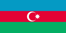
| Flag of Azerbaijan | |
The Azerbaijan Democratic Republic proclaimed its independence from the Transcaucasian Democratic Federative Republic in 1918 and became the first secular democratic Muslim-majority state. In 1920, the country was incorporated into the Soviet Union as the Azerbaijan SSR. The modern Republic of Azerbaijan proclaimed its independence on 30 August 1991, shortly before the dissolution of the Soviet Union in the same year. In September 1991, the ethnic Armenian majority of the Nagorno-Karabakh region formed the self-proclaimed Republic of Artsakh. The region and seven surrounding districts are internationally recognized as part of Azerbaijan pending a solution to the status of the Nagorno-Karabakh through negotiations facilitated by the OSCE, although became de facto independent with the end of the First Nagorno-Karabakh War in 1994. Following the Second Nagorno-Karabakh War in 2020, the seven districts and parts of Nagorno-Karabakh were returned to Azerbaijani control.
Currency / Language
| ISO | Currency | Symbol | Significant figures |
|---|---|---|---|
| AZN | Azerbaijani manat | ₼ | 2 |
| ISO | Language |
|---|---|
| HY | Armenian language |
| AZ | Azerbaijani language |
| RU | Russian language |


