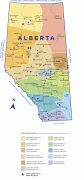
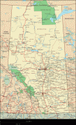
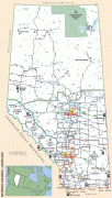
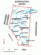
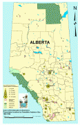
Alberta
 |
 |
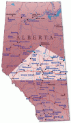
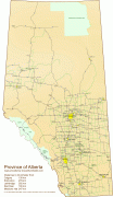
Alberta is the fourth largest province by area at 661848 km2, and the fourth most populous, being home to 4,262,635 people. Alberta's capital is Edmonton, while Calgary is its largest city. The two are Alberta's largest census metropolitan areas. More than half of Albertans live in either Edmonton or Calgary, which contributes to continuing the rivalry between the two cities. English is the official language of the province. In 2016, 76.0% of Albertans were anglophone, 1.8% were francophone and 22.2% were allophone.
Alberta's economy is based on hydrocarbons, petrochemical industries, livestock and agriculture. The oil and gas industry has been a pillar of Alberta's economy since 1947, when substantial oil deposits were discovered at Leduc No. 1 well. It has also become a part of the province's identity. Since Alberta is the province most rich in hydrocarbons, it provides 70% of the oil and natural gas exploited on Canadian soil. In 2018, Alberta's output was CA$338.2 billion, 15.27% of Canada's GDP.
In the past, Alberta's political landscape hosted parties like the centre-left Liberals and the agrarian United Farmers of Alberta. Today, Alberta is generally perceived as a conservative province. The right-wing Social Credit Party held office continually from 1935 to 1971 before the centre-right Progressive Conservatives held office continually from 1971 to 2015, the latter being the longest unbroken run in government at the provincial or federal level in Canadian history.
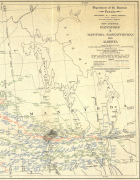
Before becoming part of Canada, Alberta was home to several First Nations like Plains Indians and Woodland Cree. It was also a territory used by fur traders of the rival companies Hudson's Bay Company and North West Company. The Dominion of Canada bought the lands that would become Alberta as part of the NWT in 1870. From the late 1800s to early 1900s, many immigrants arrived to prevent the prairies from being annexed by the US. Growing wheat and cattle ranching also became very profitable. In 1905, the Alberta Act was passed, creating the province of Alberta. Massive oil reserves were discovered in 1947. The exploitation of oil sands began in 1967.
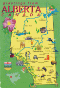
Alberta is renowned for its natural beauty, richness in fossils and for housing important nature reserves. Alberta is home to six UNESCO designated World Heritage Sites: the Canadian Rocky Mountain Parks, Dinosaur Provincial Park, Head-Smashed-In Buffalo Jump, Waterton-Glacier International Peace Park, Wood Buffalo National Park and Writing-on-Stone Provincial Park. Other popular sites include Banff National Park, Elk Island National Park, Jasper National Park, Waterton Lakes National Park, and Drumheller.
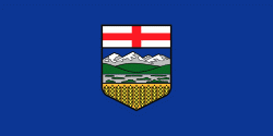
Alberta was named after Princess Louise Caroline Alberta (1848–1939), the fourth daughter of Queen Victoria. Princess Louise was the wife of John Campbell, Marquess of Lorne, Governor General of Canada (1878–83). Lake Louise and Mount Alberta were also named in her honour.
The name "Alberta" itself is a feminine Latinized form of Albert, the name of Princess Louise's father, the Prince Consort (cf., masculine) and its Germanic cognates, ultimately derived from the Proto-Germanic language *Aþalaberhtaz (compound of "noble" + "bright/famous").
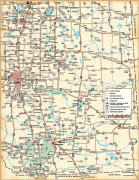
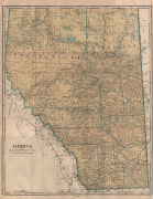
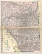
Map - Alberta
Map


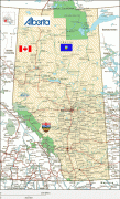


Country - Canada
 |
 |
| Flag of Canada | |
Indigenous peoples have continuously inhabited what is now Canada for thousands of years. Beginning in the 16th century, British and French expeditions explored and later settled along the Atlantic coast. As a consequence of various armed conflicts, France ceded nearly all of its colonies in North America in 1763. In 1867, with the union of three British North American colonies through Confederation, Canada was formed as a federal dominion of four provinces. This began an accretion of provinces and territories and a process of increasing autonomy from the United Kingdom. This widening autonomy was highlighted by the Statute of Westminster 1931 and culminated in the Canada Act 1982, which severed the vestiges of legal dependence on the Parliament of the United Kingdom.
Currency / Language
| ISO | Currency | Symbol | Significant figures |
|---|---|---|---|
| CAD | Canadian dollar | $ | 2 |
| ISO | Language |
|---|---|
| EN | English language |
| FR | French language |
| IU | Inuktitut |


