Albina (Albina)
Albina is a town in eastern Suriname, and is capital of the Marowijne District. The town lies on the west bank of the Marowijne river (Maroni river), which forms the border with French Guiana, directly opposite the French Guianan town of Saint-Laurent-du-Maroni, to which it is connected by a frequent ferry service. Albina can be reached by bus via the East-West Link. The distance between Paramaribo and Albina is about 150 km.
Albina was founded on 13 December 1845 by August Kappler, and was named after his wife Albina Josefine Liezenmaier (1815-1904). Kappler had left Germany, and journeyed to Suriname. In February 1845 he noticed an abandoned indigenous village near the Maroni river. Later he met friendly indigenous and Maroon people nearby, and decided to settle in the village after having received permission. By 1913, there was a little town with a medical clinic, and Albina was home to 349 men and 266 women.
On 22 July 1986, the Surinamese Interior War started. That night, the Jungle Commando, led by Ronnie Brunswijk, opened fire on the army barracks in Albina. The fighting lasted three hours. One soldier and two civilians were wounded. The National Army responded by destroying the temple in Moengotapoe, and capturing all males present. During the civil war (1986–1992) which followed, great parts of the area, including much of the town of Albina, and the road, were destroyed. It also caused a refugee crisis into French Guiana. The birthplace of Ronnie Brunswijk is the village of Moiwana Moiwana was the scene of the Moiwana massacre of 1986 where 35 people, mostly women and children were killed by the National Army.
On 24–25 December 2009, the Albina riots took place, when local Maroon inhabitants attacked Brazilian, Chinese, Colombian and Peruvian gold prospectors after a man was allegedly stabbed to death by a Brazilian. The riots caused one death, and at least 24 wounded.
Map - Albina (Albina)
Map


Country - Suriname
 |
 |
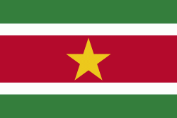
| Flag of Suriname | |
It has a population of approximately, dominated by descendants from the slaves and labourers brought in from Africa and Asia by the Dutch Empire and Republic. Most of the people live by the country's (north) coast, in and around its capital and largest city, Paramaribo. It is also one of the least densely populated countries on Earth. Situated slightly north of the equator, Suriname is a tropical country covered in rainforests. Its extensive tree cover is vital to the country's efforts to mitigate climate change and maintain carbon negativity. A developing country with a relatively high level of human development, Suriname's economy is heavily dependent on its abundant natural resources, namely bauxite, gold, petroleum, and agricultural products.
Currency / Language
| ISO | Currency | Symbol | Significant figures |
|---|---|---|---|
| SRD | Surinamese dollar | $ | 2 |
| ISO | Language |
|---|---|
| NL | Dutch language |
| EN | English language |
| JV | Javanese language |