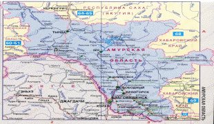
Amur Oblast (Amur Oblast)
 |
 |
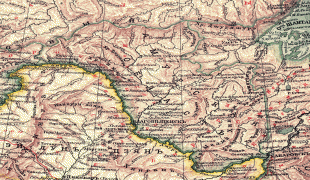
Amur Krai (Аму́рский край) or Priamurye (Приаму́рье) were unofficial names for the Russian territories by the Amur River used in the late Russian Empire that approximately correspond to modern Amur Oblast.
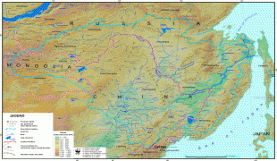
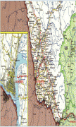
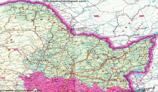
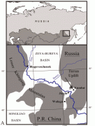
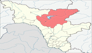
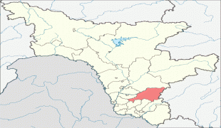
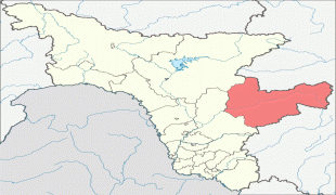
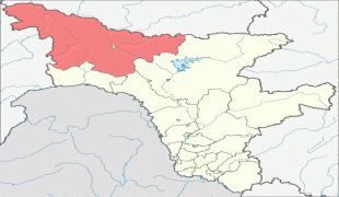
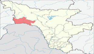
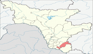
Amur Oblast is located in the southeast of Russia, between Stanovoy Range in the north and the Amur River in the south, and borders with the Sakha Republic in the north, Khabarovsk Krai and the Jewish Autonomous Oblast in the east, Heilongjiang of China in the south, and with Zabaykalsky Krai in the west. The Stanovoy Range forms the dividing line between the Sakha Republic and Amur Oblast and spreads across the oblast's entire northern border. The Amur–Zeya and Zeya–Bureya Plains cover about 40% of the oblast's territory, but the rest is hilly. Several mountain ranges rise to the south of Stanovoy Range, including the Selemdzha Range parallel to it, as well as the Ezop, Yam-Alin and the Turan ranges stretching along the oblast's southeastern border with Khabarovsk Krai.
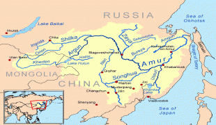
Many rivers flow through the oblast, especially in the north, accounting for 75% of the hydropower resources in the Russian Far East. Most of the oblast is in the Amur's drainage basin, although the rivers in the northwest drain into the Lena and the rivers in the northeast drain into the Uda. The longest rivers include the Amur, Bureya, Gilyuy, Nyukzha, Olyokma, Selemdzha, and Zeya. The Zeya begins in the mountains in the northeast, and its middle reaches are dammed to create the huge Zeya Reservoir, which sprawls over 2400 km2.
Climate is temperate continental, with cold, dry winters and hot, rainy summers. Average January temperatures vary from -24 C in the south to -33 C in the north. Average July temperatures are +21 C in the south and +18 C in the north. Annual precipitation is about 850 mm.
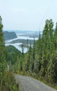
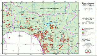
Dwarf Siberian pine and alpine tundra grow at higher elevations and larch forests with small stands of flat-leaved birch and pine forests grow alongside the river plains. These larch and fir-spruce forests form the watershed of the Selemdzha River. The Bureya and Arkhara Rivers, southeast of the Selemdza, have the richest remaining forests in the oblast with Korean pine, Schisandra chinensis, Mongolian Oak, and other Manchurian flora. The Zeya–Bureya Plain, located between the Zeya, Amur, and Bureya Rivers, has the highest biodiversity in Amur Oblast. Much of this plain has been burned for agriculture, but large patches still remain. Japanese Daurian and Far Eastern western cranes nest here, as well as a host of other rare birds.
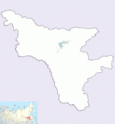
Map - Amur Oblast (Amur Oblast)
Map


Country - Russia
 |
 |
| Flag of Russia | |
The East Slavs emerged as a recognisable group in Europe between the 3rd and 8th centuries CE. The first East Slavic state, Kievan Rus', arose in the 9th century, and in 988, it adopted Orthodox Christianity from the Byzantine Empire. Rus' ultimately disintegrated, with the Grand Duchy of Moscow growing to become the Tsardom of Russia. By the early 18th century, Russia had vastly expanded through conquest, annexation, and the efforts of Russian explorers, developing into the Russian Empire, which remains the third-largest empire in history. However, with the Russian Revolution in 1917, Russia's monarchic rule was abolished and replaced by the Russian SFSR—the world's first constitutionally socialist state. Following the Russian Civil War, the Russian SFSR established the Soviet Union (with three other Soviet republics), within which it was the largest and principal constituent. At the expense of millions of lives, the Soviet Union underwent rapid industrialization in the 1930s, and later played a decisive role for the Allies of World War II by leading large-scale efforts on the Eastern Front. With the onset of the Cold War, it competed with the United States for global ideological influence; the Soviet era of the 20th century saw some of the most significant Russian technological achievements, including the first human-made satellite and the first human expedition into outer space.
Currency / Language
| ISO | Currency | Symbol | Significant figures |
|---|---|---|---|
| RUB | Russian ruble | ₽ | 2 |
| ISO | Language |
|---|---|
| CE | Chechen language |
| CV | Chuvash language |
| KV | Komi language |
| RU | Russian language |
| TT | Tatar language |


