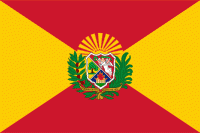
Aragua State (Estado Aragua, ) is one of the 23 states of Venezuela. It is located in the north-central region of Venezuela. It has plains and jungles and Caribbean beaches. The most popular are Cata and Choroni. It has Venezuela's first national park which is called Henri Pittier. The capital is Maracay, other important cities include Turmero and El Limón.
Aragua State covers a total surface area of 7,014 km2 and, based on the 2011 census information, the estimated population of Aragua State in 2012 is 1,630,308 inhabitants.
The name of the state comes from an indigenous word of Cumanagoto (Caribbean) origin, which is used to refer to the Chaguaramo, a type of palm from the region [quotation required] However, according to Carlos Blanco Galeno, a chronicler from Turmero, it derives from the Cariban aregua, and this de are ('site') and gua which in turn derives from ogun ('my thing'), so it would mean 'my place, my country'. This same word inspired the name of the Aragua River, an important tributary of Lake Valencia.