Arish
ʻArish or el-ʻArīsh (العريش al-ʿArīš, ϩⲣⲓⲛⲟⲕⲟⲣⲟⲩⲣⲁ Hrinokorura) is the capital and largest city (with 164,830 inhabitants ) of the North Sinai Governorate of Egypt, as well as the largest city on the Sinai Peninsula, lying on the Mediterranean coast 344 km northeast of Cairo and 45 km west of the Egypt-Gaza border.
ʻArīsh is located at the mouth of Wadi el-ʻArīsh, a 250 km long ephemeral watercourse. The Azzaraniq Protectorate is on the eastern side of ʻArīsh.
The earliest historical reference to the city is found in the Septuagint, Isaiah 27:12. The city grew around a Bedouin settlement near the ancient Ptolemaic outpost of Rhinocorura (in Greek "the place where noses (of criminals) are cut off"). In the Middle Ages, pilgrims misidentified the site as the Sukkot of the Bible. ʻArīsh means "palm huts" in Modern Standard Arabic. M. Ignace de Rossi derived the Arabic name from the Egyptian ϫⲟⲣϣⲁ(ⲓ), an analogue of Greek Rhinocorura.
New fortifications were constructed at the original site by the Ottoman Empire in 1560. During the Napoleonic Wars, the French laid siege to the fort, which fell after 11 days on February 19, 1799. During World War I, the fort was destroyed by British bombers. It was later the location of the 45th Stationary Hospital which treated casualties of the Palestine campaign. The remains of those who died there were later moved to Kantara Cemetery.
Theodor Herzl, the founder of Zionism, proposed ʻArīsh as a Jewish homeland since neither the Sultan nor the Kaiser supported settlement in Palestine. In 1903, Joseph Chamberlain, the British colonial secretary, agreed to consider ʻArīsh, and Herzl commissioned the lawyer David Lloyd George a charter draft, but his application was turned down once an expedition, led by Leopold Kessler had returned and submitted a detailed report to Herzl, which outlined a proposal to divert some of the Nile waters to the area for the purpose of settlement.
El-ʻArīsh Military Cemetery was built in 1919 marked the dead of World War I. It was designed by Robert Lorimer.
On December 8, 1958, an air battle occurred between Egyptian and Israeli air forces over ʻArīsh. ʻArīsh was under military occupation by Israel briefly in 1956 and again from 1967 to 1979. It was returned to Egypt in 1979 after the signing of the Egypt–Israel peace treaty.
In the Sinai mosque attack of 24 November 2017, 305 people were killed in a bomb and gun attack at the mosque in al-Rawda, 45 km west of ʻArīsh.
On 9 February 2021 six locals were killed by ISIL militants.
Map - Arish
Map
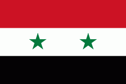
Country - United_Arab_Republic
 |
 |
| Flag of Egypt | |
The republic was led by Egyptian President Gamal Abdel Nasser. The UAR was a member of the United Arab States, a loose confederation with the Mutawakkilite Kingdom of Yemen, which was dissolved in 1961.
Currency / Language
| ISO | Currency | Symbol | Significant figures |
|---|---|---|---|
| EGP | Egyptian pound | £ or جم | 2 |
| ISO | Language |
|---|---|
| AR | Arabic language |
| EN | English language |
| FR | French language |


