Arno Atoll (Arno Atoll)
Arno Atoll (Arņo, ) is a coral atoll of 133 islands in the Pacific Ocean, and forms a legislative district of the Ratak Chain of the Marshall Islands. Its total land area is only 5 sqmi. Unlike most other atolls, Arno encloses three different lagoons, a large central one, and two smaller ones in the north and east. Its main lagoon encloses an area of 130.77 sqmi. At a distance of only 20 km, it is the closest atoll to the Marshall Islands capital, Majuro Atoll, and can be seen looking east from Majuro on a clear day at low tide. The population of Arno Atoll was 1,794 at the 2011 census. The most populous islets are Ajeltokrok, Kobjeltak, Rearlaplap, Langor and Tutu. The largest village is Ine, Arno.
People of Arno are well known for their productivity in making copra (the dried out meat of coconuts, from which coconut oil is extracted). Arno women are renowned for their production of the Kili Bag, a popular handwoven handbag/purse, named after another island in the Marshall Islands (to which the people of Bikini were eventually relocated as a result of the US nuclear tests that were conducted on their home atoll). Arno supposedly had a traditional "love school".
Arno Atoll was claimed by the Empire of Germany along with the rest of the Marshall Islands in 1884. After World War I, the island came under the South Seas Mandate of the Empire of Japan. Following the end of World War II, Arno Atoll came under the control of the United States as part of the Trust Territory of the Pacific Islands. The island has been part of the independent Republic of the Marshall Islands since 1986.
Map - Arno Atoll (Arno Atoll)
Map


Country - Marshall_Islands
 |
 |
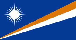
| Flag of the Marshall Islands | |
The country's population of 42,050 people (at the 2021 World Bank Census ) is spread out over five islands and 29 coral atolls, comprising 1,156 individual islands and islets. The capital and largest city is Majuro. It has the largest portion of its territory composed of water of any sovereign state, at 97.87%. The islands share maritime boundaries with Wake Island to the north, Kiribati to the southeast, Nauru to the south, and the Federated States of Micronesia to the west. About 52.3% of Marshall Islanders (27,797 at the 2011 Census) live on Majuro. In 2016, 73.3% of the population were defined as being "urban". The UN also indicates a population density of 295 PD/km2, and its projected 2020 population is 59,190.
Currency / Language
| ISO | Currency | Symbol | Significant figures |
|---|---|---|---|
| USD | United States dollar | $ | 2 |
| ISO | Language |
|---|---|
| EN | English language |
| MH | Marshallese language |