Arrondissement of Brussels-Capital (Arrondissement Brussel-Hoofdstad)
The arrondissement was created in 1963 upon the splitting of the arrondissement of Brussels into the capital one and the surrounding arrondissement of Halle-Vilvoorde. They remained part of the province of Brabant until it was split as well in 1995. In that year, the arrondissement of Nivelles formed the new Walloon Brabant and the arrondissements of Halle-Vilvoorde and Leuven formed the new Flemish Brabant. The arrondissement of Brussels-Capital, corresponding to the Brussels-Capital Region, thus became extraprovincial, meaning it is not a province, neither does it belong to one, nor does it contain any. However, it was the only Belgian arrondissement that was headed by a governor and a vice-governor until 2014 when these posts were abolished in accord with the 2011 state reform.
The Brussels-Capital Region is divided into 19 municipalities, of which the City of Brussels is the largest and most populous. See the list of municipalities of the Brussels-Capital Region.
The governor exercised most of the few remaining powers elsewhere exercised by a provincial governor, particularly in the field of public order, as far as no (federal) law, (regional) decree, ordonnance or decision states otherwise. The governor was appointed by the government of the Brussels-Capital Region on the unanimous advice of the Federal Council of Ministers. The regional government also appointed the vice-governor, who was required to have a considerable knowledge of both the Dutch French and who had a duty to ensure that the legislation regarding the use of languages was observed in the Brussels region.
Map - Arrondissement of Brussels-Capital (Arrondissement Brussel-Hoofdstad)
Map
Country - Belgium
 |
 |
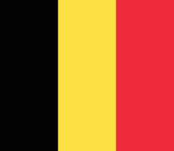
| Flag of Belgium | |
Belgium is a sovereign state and a federal constitutional monarchy with a parliamentary system. Its institutional organization is complex and is structured on both regional and linguistic grounds. It is divided into three highly autonomous regions: the Flemish Region (Flanders) in the north, the Walloon Region (Wallonia) in the south, and the Brussels-Capital Region. Brussels is the smallest and most densely populated region, as well as the richest region in terms of GDP per capita. Belgium is also home to two main linguistic communities: the Flemish Community, which constitutes about 60 percent of the population, and the French Community, which constitutes about 40 percent of the population. A small German-speaking Community, numbering around one percent, exists in the East Cantons. The Brussels-Capital Region is officially bilingual in French and Dutch, although French is the dominant language.
Currency / Language
| ISO | Currency | Symbol | Significant figures |
|---|---|---|---|
| EUR | Euro | € | 2 |
| ISO | Language |
|---|---|
| NL | Dutch language |
| FR | French language |
| DE | German language |


