Arta Region (Arta Region)
The capital of Arta Region is Arta. Other towns include We`a, Damerjog and Loyada. The Hemed mountain is the highest point in the region of Arta.
Nomadic life in the Arta Region dates back at least 2,000 years. During the Middle Ages, the Arta Region was ruled by the Ifat Sultanate and the Adal Sultanate. It later formed a part of the French Somaliland protectorate in the first half of the 20th century. Loyada village has a beautiful beach and a picturesque palm grove and the tombs of great historical leaders of this region. Halfway between Loyada and Djibouti, the small village of Damerjog and gardens with traditional irrigation systems. The Region of Arta is situated at the boundary of the Afar and Issa Somali sociolinguistic groups.
Map - Arta Region (Arta Region)
Map
Country - Djibouti
 |
 |
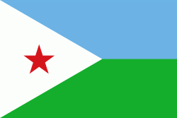
| Flag of Djibouti | |
In antiquity, the territory, together with Ethiopia, Eritrea and Somaliland, was part of the Land of Punt. Nearby Zeila, now in Somaliland, was the seat of the medieval Adal and Ifat Sultanates. In the late 19th century, the colony of French Somaliland was established after the ruling Dir Somali sultans signed treaties with the French, and its railroad to Dire Dawa (and later Addis Ababa) allowed it to quickly supersede Zeila as the port for southern Ethiopia and the Ogaden. It was renamed the French Territory of the Afars and the Issas in 1967. A decade later, the Djiboutian people voted for independence. This officially marked the establishment of the Republic of Djibouti, named after its capital city. The new state joined the United Nations. In the early 1990s, tensions over government representation led to armed conflict, which ended in a power-sharing agreement in 2000 between the ruling party and the opposition.
Currency / Language
| ISO | Currency | Symbol | Significant figures |
|---|---|---|---|
| DJF | Djiboutian franc | Fr | 0 |
| ISO | Language |
|---|---|
| AA | Afar language |
| AR | Arabic language |
| FR | French language |
| SO | Somali language |


