Atafu
Atafu, formerly known as the Duke of York Group, is a group of 52 coral islets within Tokelau in the south Pacific Ocean, 500 km north of Samoa. With a land area of 2.5 km2, it is the smallest of the three islands that constitute Tokelau. It is an atoll and surrounds a central lagoon, which covers some 15 km2. The atoll lies some 800 km south of the equator at 8° 35' South, 172° 30' West.
According to the 2016 census, 541 people officially live on Atafu (although only 413 were present the night the census was taken). Of those present, 78% belong to the Congregational Church. The main settlement on the atoll is located on Atafu Island in its northwestern corner. The Presbyterian church was established on the island in 1858, but today almost all of the residents belong to the Congregational Christian Church. The first village on Atafu was established at its southern end: Residents built houses along the lagoon shore to take best advantage of the cooling trade winds.
Fishing is traditionally done by the men on Atafu, and they are highly skilled at it. They use many traditional methods that are passed on from fathers to sons. They create very effective lures, fish traps, nets, and seines. They commonly use the technique called "noose fishing", in which a circle of rope, tied with a noose knot, is dangled in the water; a large fish swims into the rope circle, lured by bait, and the noose is then tightened around its body, holding it fast. They also make well-crafted canoes, which they use for their fishing expeditions.
Map - Atafu
Map
Country - Tokelau
 |
 |
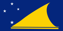
Tokelau has a population of approximately 1,500 people; it has the fourth-smallest population of any sovereign state or dependency in the world. As of the 2016 census, around 45% of its residents had been born overseas, mostly in Samoa or New Zealand. The populace has a life expectancy of 69, which is comparable to that of other Oceanian island nations. Approximately 94% of the population speak Tokelauan as their first language. Tokelau has the smallest economy of any nation, although it is a leader in renewable energy, being the first 100% solar-powered nation in the world.
Currency / Language
| ISO | Currency | Symbol | Significant figures |
|---|---|---|---|
| NZD | New Zealand dollar | $ | 2 |
| ISO | Language |
|---|---|
| EN | English language |


