Bahrain Island (Bahrain)
Bahrain Island (جزيرة البحرين Jazīrah al-Baḥrayn), also known as al-Awal Island and formerly as Bahrein, is the largest island within the archipelago of Bahrain, and forms the bulk of the country's land mass while hosting the majority of its population.
Most of the island of Bahrain is in a relatively shallow inlet of the Persian Gulf known as the Gulf of Bahrain. The seabed adjacent to Bahrain is rocky and, mainly off the northern part of the island, covered by extensive coral reefs. Most of the island is low-lying and barren desert. Outcroppings of limestone form low rolling hills, stubby cliffs, and shallow ravines. The limestone is covered by various densities of saline sand, capable of supporting only the hardiest desert vegetation such as chiefly thorn trees and scrubs. A 5 km wide fertile strip of land exists along the northern coast on which date, almond, fig, and pomegranate trees grow. The interior contains an escarpment that rises to 134 m, the highest point on the island, to form the Mountain of Smoke, named as such due to the mists that often wreathe the summit. Most of the country's oil wells are situated in the vicinity of the mountain.
Most of the island of Bahrain is in a relatively shallow inlet of the Persian Gulf known as the Gulf of Bahrain. The seabed adjacent to Bahrain is rocky and, mainly off the northern part of the island, covered by extensive coral reefs. Most of the island is low-lying and barren desert. Outcroppings of limestone form low rolling hills, stubby cliffs, and shallow ravines. The limestone is covered by various densities of saline sand, capable of supporting only the hardiest desert vegetation such as chiefly thorn trees and scrubs. A 5 km wide fertile strip of land exists along the northern coast on which date, almond, fig, and pomegranate trees grow. The interior contains an escarpment that rises to 134 m, the highest point on the island, to form the Mountain of Smoke, named as such due to the mists that often wreathe the summit. Most of the country's oil wells are situated in the vicinity of the mountain.
Map - Bahrain Island (Bahrain)
Map
Country - Bahrain
 |
 |
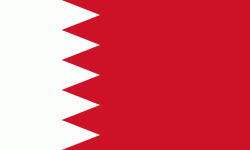
| Flag of Bahrain | |
Bahrain is the site of the ancient Dilmun civilization. It has been famed since antiquity for its pearl fisheries, which were considered the best in the world into the 19th century. Bahrain was one of the earliest areas to be influenced by Islam, during the lifetime of Muhammad in 628 AD. Following a period of Arab rule, Bahrain was ruled by the Portuguese Empire from 1521 until 1602, when they were expelled by Shah Abbas I of the Safavid dynasty. In 1783, the Bani Utbah clan captured Bahrain from Nasr Al-Madhkur and it has since been ruled by the Al Khalifa royal family, with Ahmed al Fateh as Bahrain's first hakim.
Currency / Language
| ISO | Currency | Symbol | Significant figures |
|---|---|---|---|
| BHD | Bahraini dinar | د.ب | 3 |
| ISO | Language |
|---|---|
| AR | Arabic language |
| EN | English language |
| FA | Persian language |
| UR | Urdu |


