Bikini Atoll (Bikini Atoll)
The atoll is at the northern end of the Ralik Chain, approximately 530 mi northwest of the capital Majuro. Three families were resettled on Bikini island in 1970, totaling about 100 residents, but scientists found dangerously high levels of strontium-90 in well water in May 1977, and the residents were carrying abnormally high concentrations of caesium-137 in their bodies. They were evacuated again in 1980. The atoll is occasionally visited today by divers and a few scientists, and is occupied by a handful of caretakers.
The island's English name is derived from the German colonial name Bikini given to the atoll when it was part of German New Guinea. The German name is transliterated from the Marshallese name for the island, Pikinni, "Pik" meaning "plane surface" and "Ni" meaning "coconut tree", or surface of coconuts.
Map - Bikini Atoll (Bikini Atoll)
Map


Country - Marshall_Islands
 |
 |
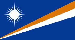
| Flag of the Marshall Islands | |
The country's population of 42,050 people (at the 2021 World Bank Census ) is spread out over five islands and 29 coral atolls, comprising 1,156 individual islands and islets. The capital and largest city is Majuro. It has the largest portion of its territory composed of water of any sovereign state, at 97.87%. The islands share maritime boundaries with Wake Island to the north, Kiribati to the southeast, Nauru to the south, and the Federated States of Micronesia to the west. About 52.3% of Marshall Islanders (27,797 at the 2011 Census) live on Majuro. In 2016, 73.3% of the population were defined as being "urban". The UN also indicates a population density of 295 PD/km2, and its projected 2020 population is 59,190.
Currency / Language
| ISO | Currency | Symbol | Significant figures |
|---|---|---|---|
| USD | United States dollar | $ | 2 |
| ISO | Language |
|---|---|
| EN | English language |
| MH | Marshallese language |