Bila Tserkva (Bila Tserkva)
 |
 |
The ancient city of Bila Tserkva was founded in 1032 to provide important defenses against nomadic tribes. In the 13th century, it was invaded by the Mongols, however, and the city was devastated. In 1651, it was the site of an important battle between the warring Zaporozhian Cossack Army (and their Tatar allies) and the Polish–Lithuanian Commonwealth, but Bila Tserkva was also where they made peace, and signed a Treaty. In 1791, Russia's Catherine II included Bila Tserkva in the region that came to be known as the Pale of Settlement, which encompassed parts of seven contemporary nations, including large swaths of modern-day Ukraine.
Architecturally, the town is known for a variety of late 18th and early 19th-century buildings, courtesy of the Branickis, who ruled there during this era. Highlights include: "The Winter Palace on the bank of the Ros River, the Summer Palace, an ensemble of postal station buildings, the Church of Saint John the Baptist (1789–1812), the Transfiguration Cathedral (1833–9), and the Church of Saint Mary Magdalene (1843). The Church of Saint Nicholas, whose construction was initiated by Hetman Ivan Mazepa and Colonel Kostiantyn Maziievsky in 1706, and was finally completed in 1852."By the late 19th century, Jews would comprise nearly half the population of the city. An important Jewish center, it also evolved into an active center for the exchange of influential ideas about politics, religion, art, and culture, with an active Zionist movement, an active branch of the Decembrist movement and a branch of the Society of United Slavs formulating "plans to assassinate Tsar Alexander I." A center of Hassidim, it also hosted vigorous factions arguing for assimilation. Home to many artists and writers, Sholem Aleichem and Shaye Shkarovsky spend periods writing there in Yiddish, and Ivan Nechuy-Levytsky was also writing in Ukrainian during this era.
An important regional center during Lithuanian and, later, Polish rule, the city remained prominent due to its close proximity to Kyiv, and its place at the center of Europe's "breadbasket," with some of the continent's most fertile land. The city economy first began diversifying in the late 1700s when the Oleksandriia Dendrological Park was first built. In 1809–14, Market Stalls were created to provide space for 85 merchants at a time when the grain trade and sugar industry also began to contribute to the growth of the city. By 1850, Bila Tserkva had built its first major factory. Later, it specialized in building machines for everything from the production of feed for livestock, to tires, to clothing." In 1929, the Bila Tserkva National Agrarian University was founded in as a scientific research center, which now specializes in academic research focusing on environmental protection, veterinary welfare and biosafety.
During the first two decades of the 20th century, the city's Jewish residents were subject to multiple pogroms. In 1919 and 1920 alone, pogroms were responsible for the deaths of 850 Jews. In 1932–1933, as many as 22,000 of greater Bila Tserkva's residents died in the Holodomor.
During the Second World War, the city was occupied by Nazi Germany as part of Operation Barbarossa, resulting in the 1941 massacre of the city's Jewish population. The city was recaptured by Soviet forces and returned to the control of the Ukrainian Soviet Socialist Republic in 1944. In 1991, Ukraine declared independence.
Founded in 1032, the city was originally named Yuriiv by Yaroslav the Wise, whose Christian name was Yuri. The contemporary name of the city, literally translated, is "White Church" and may refer to the white-painted cathedral (no longer extant) of medieval Yuriiv. In its long history, Bila Tserkva spent its first few hundred years privately owned, later, though the owner was typically a citizen of the ruling empire, it was organized as a fiefdom.
From its earliest incarnation, however, Bila Tserkva was considered to provide important defense against nomadic tribes that included both the Cumans and the Tatars. Its defenses failed during a 13th-century Mongol invasion, however, and the city was devastated.
Map - Bila Tserkva (Bila Tserkva)
Map


Country - Ukraine
 |
 |
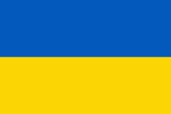
| Flag of Ukraine | |
During the Middle Ages, Ukraine was the site of early Slavic expansion and the area later became a key centre of East Slavic culture under the state of Kievan Rus', which emerged in the 9th century. The state eventually disintegrated into rival regional powers and was ultimately destroyed by the Mongol invasions of the 13th century. The area was then contested, divided, and ruled by a variety of external powers for the next 600 years, including the Polish–Lithuanian Commonwealth, the Austrian Empire, the Ottoman Empire, and the Tsardom of Russia. The Cossack Hetmanate emerged in central Ukraine in the 17th century, but was partitioned between Russia and Poland, and ultimately absorbed by the Russian Empire. Ukrainian nationalism developed, and following the Russian Revolution in 1917, the short-lived Ukrainian People's Republic was formed. The Bolsheviks consolidated control over much of the former empire and established the Ukrainian Soviet Socialist Republic, which became a constituent republic of the Soviet Union when it was formed in 1922. In the early 1930s, millions of Ukrainians died in the Holodomor, a man-made famine. During World War II, Ukraine was devastated by the German occupation.
Currency / Language
| ISO | Currency | Symbol | Significant figures |
|---|---|---|---|
| UAH | Ukrainian hryvnia | â‚´ | 2 |
| ISO | Language |
|---|---|
| HU | Hungarian language |
| PL | Polish language |
| RU | Russian language |
| UK | Ukrainian language |