Brazzaville (Commune de Brazzaville)
Brazzaville (, Kintamo, Nkuna, Kintambo, Ntamo, Mavula, Tandala, Mfwa, Mfua; Teke: M'fa, Mfaa, Mfa, Mfoa ) is the capital and largest city of the Republic of the Congo (Congo Republic). Constituting the financial and administrative centre of the country, it is located on the north side of the Congo River, opposite Kinshasa, the capital city of the Democratic Republic of the Congo (DR Congo).
The population of the capital is estimated to exceed 1.8 million residents, comprising more than a third of the national populace. Some 40% are employed in non-agricultural professions. During World War II, Brazzaville was also the capital of Free France between 1940 and 1942.
In 2013, Brazzaville was designated a City of Music by UNESCO; since then it has also been a member of the Creative Cities Network.
Brazzaville covers a large area to the north of the Congo River, just below the Pool Malebo. Mbamu, a large island within the Pool, is part of the Republic of Congo's territory.
Brazzaville is 506 km inland from the Atlantic Ocean and approximately 474 km south of the equator. The city is a commune that is separated from the other regions of the republic; it is surrounded by the Pool Department. Around the city are large plains. The town is relatively flat, and situated at an altitude of 317 m. Downriver the Congo has numerous rapids, known as Livingston Falls, preventing navigation upriver to this point from its mouth at the Atlantic.
Kinshasa, the capital of the Democratic Republic of the Congo, is located on the southern bank of the Congo, directly across from Brazzaville. To distinguish between the two African countries that have "Congo" in their names, the Republic of the Congo is sometimes called Congo-Brazzaville, as opposed to Congo-Kinshasa. Kinshasa is more than five times larger than Brazzaville in population. This is the only place in the world where two national capital cities developed on opposite banks of a river, within sight of each other.
In March 2018, the "Brazzaville Declaration" was signed to promote better management and conservation of the Cuvette Centrale, a region in Congo Basin and primarily in DRC. It is the world's largest tropical peatland, made up of swamp forests. Conservation of this area is important for the survival of megafauna, and also critical to the world's climate. Burning the peat would release too much carbon and raise the earth's temperature. The declaration to save peatlands as the world's largest terrestrial organic carbon stock was signed by Democratic Republic of the Congo, the Republic of the Congo, and Indonesia, which also has peatlands.
Map - Brazzaville (Commune de Brazzaville)
Map
Country - Republic_of_the_Congo
 |
 |
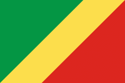
| Flag of the Republic of the Congo | |
The region was dominated by Bantu-speaking tribes at least 3,000 years ago, who built trade links leading into the Congo River basin. Congo was formerly part of the French colony of Equatorial Africa. The Republic of the Congo was established on 28 November 1958 and gained independence from France in 1960. It was a Marxist–Leninist state from 1969 to 1992, under the name People's Republic of the Congo. The country has had multi-party elections since 1992, but a democratically elected government was ousted in the 1997 Republic of the Congo Civil War. President Denis Sassou Nguesso who first came to power in 1979 ruled until 1992 and then again from 1997 onwards.
Currency / Language
| ISO | Currency | Symbol | Significant figures |
|---|---|---|---|
| XAF | Central African CFA franc | Fr | 0 |
| ISO | Language |
|---|---|
| FR | French language |
| KG | Kongo language |
| LN | Lingala language |


