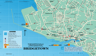
Bridgetown
 |
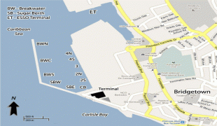
The Bridgetown port, found along Carlisle Bay (at 13.106°N, -59.632°W) lies on the southwestern coast of the island. Parts of the Greater Bridgetown area (as roughly defined by the Ring Road Bypass or more commonly known as the ABC Highway), sit close to the borders of the neighbouring parishes Christ Church and St. James. The Grantley Adams International Airport for Barbados, is located 16 km southeast of Bridgetown city centre, and has daily flights to major cities in the United Kingdom, United States, Canada and the Caribbean. There is no longer a local municipal government, but it is a constituency of the national Parliament. During the short-lived 1950s-1960s Federation of the British West Indian Territories, Bridgetown was one of three capital cities within the region being considered to be the Federal capital of the region.
The present-day location of the city was established by English settlers in 1628; a previous settlement under the authority of Sir William Courten was at St. James Town. Bridgetown is a major West Indies tourist destination, and the city acts as an important financial, informatics, convention centre, and cruise ship port of call in the Caribbean region. On 25 June 2011, "Historic Bridgetown and its Garrison" was added as a World Heritage Site of UNESCO.
Although the island was totally abandoned or uninhabited when the British arrived, one of the few traces of indigenous pre-existence on the island was a primitive bridge constructed over the Careenage area's swamp at the centre of Bridgetown. It was thought that this bridge was created by a people indigenous to the Caribbean known as the Tainos. Upon finding the structure, the British settlers began to call what is now the Bridgetown area Indian Bridge. Scholars widely believe that the Tainos were driven from Barbados to the neighbouring island of Saint Lucia, during an invasion by the Kalinagos, another indigenous people of the region. Eventually after 1654 when a new bridge was constructed over the Careenage by the British, the area became known as The Town of Saint Michael and later as Bridgetown, after Sir Tobias Bridge.
Bridgetown is the only city outside the present United States that George Washington visited. (George Washington House, the house where he stayed, is included within the boundaries of the Garrison Historic Area.) Two of Washington's ancestors, Jonathon and Gerrard Hawtaine, were early planters on the island. Their grandmother was Mary Washington of Sulgrave, Northamptonshire, England. In 2011, historic buildings in Bridgetown were designated as a protected area by UNESCO.
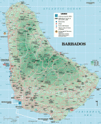
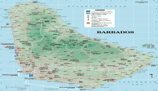
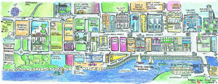
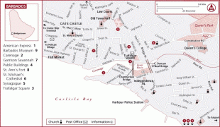
Map - Bridgetown
Map


Country - Barbados
 |
 |
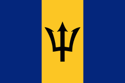
| Flag of Barbados | |
Inhabited by Kalinago people since the 13th century, and prior to that by other Amerindians, Spanish navigators took possession of Barbados in the late 15th century, claiming it for the Crown of Castile. It first appeared on a Spanish map in 1511. The Portuguese Empire claimed the island between 1532 and 1536, but abandoned it in 1620 with their only remnants being an introduction of wild boars for a good supply of meat whenever the island was visited. An English ship, the Olive Blossom, arrived in Barbados on 14 May 1625; its men took possession of the island in the name of King James I. In 1627, the first permanent settlers arrived from England, and Barbados became an English and later British colony. During this period, the colony operated on a plantation economy, relying on the labour of African slaves who worked on the island's plantations. Slavery continued until it was phased out through most of the British Empire by the Slavery Abolition Act 1833.
Currency / Language
| ISO | Currency | Symbol | Significant figures |
|---|---|---|---|
| BBD | Barbados dollar | $ | 2 |
| USD | United States dollar | $ | 2 |
| ISO | Language |
|---|---|
| EN | English language |