Buenos Aires Province (Buenos Aires)
 |
 |
It is bordered by the provinces of Entre Ríos to the northeast, Santa Fe to the north, Córdoba to the northwest, La Pampa to the west, Río Negro to the south and west and the Autonomous City of Buenos Aires to the northeast. Uruguay is just across the Rio de la Plata to the northeast, and both are on the coast of the Atlantic Ocean to the east. Almost the entire province is part of the Pampas geographical region, with the extreme south often considered part of the Patagonia region.
The province has a population of about 15.6 million people, which is 39% of Argentina's total population. Nearly 10 million people live in Greater Buenos Aires. The province covers an area of 307571 km2, which is about 11% of Argentina's total area and makes it the country's largest province.
The inhabitants of the province before the 16th-century advent of Spanish colonization were aboriginal peoples such as the Charrúas and the Querandíes. Their culture was lost over the next 350 years. They were subjected to Eurasian plagues from which few survived. The survivors joined other tribes or have been mostly absorbed by Argentina's European ethnic majority.
Pedro de Mendoza founded Santa María del Buen Ayre in 1536. Even though the first contact with the aboriginals was peaceful, it soon became hostile. The city was evacuated in 1541. Juan de Garay re-founded the settlement in 1580 as Santísima Trinidad y Puerto Santa María de Los Buenos Aires.
Amidst ongoing conflict with the aboriginals, the cattle farms extended from Buenos Aires, whose port was always the center of the economy of the territory. Following the creation of the Viceroyalty of the Río de la Plata at the end of the 18th century, the export of meat, leather and their derivatives through the port of Buenos Aires was the basis of the economic development of the region.
Jesuits unsuccessfully tried to peacefully assimilate the aboriginals into the European culture brought by the Spanish conquistadores. A certain balance was found at the end of the 18th century when the Salado River became the limit between both civilizations, despite frequent malones (aboriginal attacks on border settlements). The end to this situation came in 1879 with the Conquest of the Desert (Conquista del Desierto) in which the aboriginals were almost completely exterminated.
After the independence from Spain in 1816, the city and province of Buenos Aires became the focus of an intermittent Argentine Civil War with other provinces. A Federal Pact secured by Governor Juan Manuel de Rosas in 1831 led to the establishment of the Argentine Confederation and to his gaining the sum of public power, which provided a tenuous unity. Ongoing disputes regarding the influence of Buenos Aires, between Federalists and Unitarians, and over the Port of Buenos Aires (the prime source of public revenue at the time) fueled periodic hostilities. The province was declared independent on 11 September 1852, as the State of Buenos Aires. Concessions gained in 1859 Pact of San José de Flores and a victory at the Battle of Pavón led to its reincorporation into the Argentine Republic on 17 December 1861. Intermittent conflicts with the nation did not truly cease until 1880, when the city of Buenos Aires was formally federalized and, thus, administratively separated from the province.
La Plata was founded in 1882 by Governor Dardo Rocha for the purpose of becoming the provincial capital. The equivalent of a billion (1880s) dollars of British investment and pro-development, education and immigration policies pursued at the national level subsequently spurred dramatic economic growth. Driven by European immigration and improved health, the province's population, like Argentina's, nearly doubled to one million by 1895 and doubled again by 1914. Rail lines connected nearly every town and hamlet in the province by 1914; many developed around the new railway stations.
This era of accelerated development was cut short by the Wall Street Crash of 1929, which caused a sharp drop in commodity prices (99% of Argentine exports were agricultural) and led to a halt in the flow of investment funds between nations. The new Concordance and Perón governments funded ambitious lending and public works programs, visible in Buenos Aires Province through the panoply of levees, power plants, water works, paved roads, municipal buildings, and (particularly during Perón's 1946-55 tenure) schools, clinics and massive regional hospitals.
Map - Buenos Aires Province (Buenos Aires)
Map


Country - Argentina
 |
 |
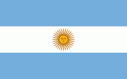
| Flag of Argentina | |
The earliest recorded human presence in modern-day Argentina dates back to the Paleolithic period. The Inca Empire expanded to the northwest of the country in Pre-Columbian times. The country has its roots in Spanish colonization of the region during the 16th century. Argentina rose as the successor state of the Viceroyalty of the Río de la Plata, a Spanish overseas viceroyalty founded in 1776. The declaration and fight for independence (1810–1818) was followed by an extended civil war that lasted until 1861, culminating in the country's reorganization as a federation. The country thereafter enjoyed relative peace and stability, with several waves of European immigration, mainly Italians and Spaniards, radically reshaping its cultural and demographic outlook; over 60% of the population has full or partial Italian ancestry, and Argentine culture has significant connections to Italian culture.
Currency / Language
| ISO | Currency | Symbol | Significant figures |
|---|---|---|---|
| ARS | Argentine peso | $ | 2 |
| ISO | Language |
|---|---|
| EN | English language |
| FR | French language |
| DE | German language |
| GN | Guarani language |
| IT | Italian language |
| ES | Spanish language |
