Cape Verde (Republic of Cabo Verde)
 |
 |
The Cape Verde archipelago was uninhabited until the 15th century, when Portuguese explorers discovered and colonized the islands, thus establishing the first European settlement in the tropics. Because the Cape Verde islands were located in a convenient location to play a role in the Atlantic slave trade, Cape Verde became economically prosperous during the 16th and 17th centuries, attracting merchants, privateers, and pirates. It declined economically in the 19th century after the suppression of the Atlantic slave trade, and many of its inhabitants emigrated during that period. However, Cape Verde gradually recovered economically by becoming an important commercial center and useful stopover point along major shipping routes. In 1951, Cape Verde was incorporated as an overseas department of Portugal, but its inhabitants continued to campaign for independence, which they achieved in 1975.
Since the early 1990s, Cape Verde has been a stable representative democracy and has remained one of the most developed and democratic countries in Africa. Lacking natural resources, its developing economy is mostly service-oriented, with a growing focus on tourism and foreign investment. Its population of around 483,628 is mostly of mixed African and European heritage, and predominantly Roman Catholic, reflecting the legacy of Portuguese rule. A sizeable Cape Verdean diaspora community exists across the world, especially in the United States and Portugal, considerably outnumbering the inhabitants on the islands. Cape Verde is a member state of the African Union.
Cape Verde's official language is Portuguese. It is the language of instruction and government. It is also used in newspapers, television, and radio. The recognized national language is Cape Verdean Creole, which is spoken by the vast majority of the population.
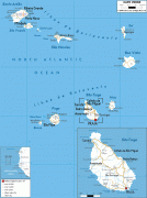
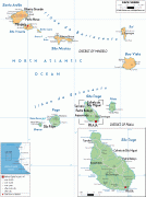
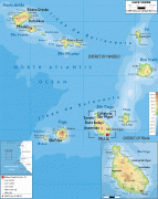
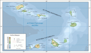
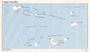
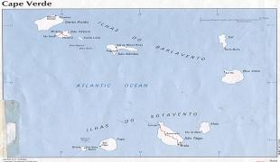
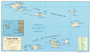
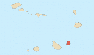
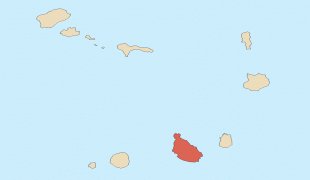
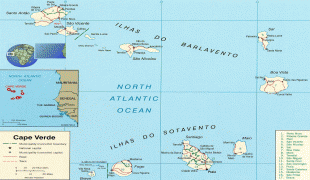
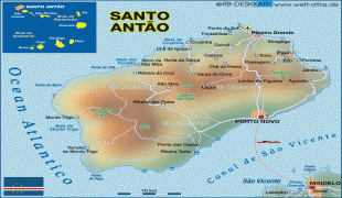
As of the 2021 census the most populated islands were Santiago where the capital Praia is located (269,370), São Vicente (74,016), Santo Antão (36,632), Fogo (33,519) and Sal (33,347). The biggest cities are Praia (137,868), Mindelo (69,013), Espargos (24,500) and Assomada (21,297).
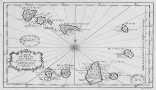
The country is named after the Cap-Vert peninsula, on the Senegalese coast. The name Cap-Vert, in turn, comes from the Portuguese language Cabo Verde ('green cape'), the name that Portuguese explorers gave the cape in 1444, a few years before they came across the islands.
On 24 October 2013, the country's delegation to the United Nations informed it that other countries should no longer use Cape Verde or any other translations of Cabo Verde as part of its official name: all countries should use Republic of Cabo Verde as the country's official name. Speakers of English have used the name Cape Verde for the archipelago and, since independence in 1975, for the country. In 2013, the Cape Verdean government determined that it would thenceforth use the Portuguese name Cabo Verde for official purposes, including at the United Nations, even when speaking or writing in English.
Currency / Language
| ISO | Currency | Symbol | Significant figures |
|---|---|---|---|
| CVE | Cape Verde escudo | Esc or $ | 2 |
| ISO | Language |
|---|---|
| PT | Portuguese language |