Map - Carabobo (Estado Carabobo)

Carabobo (Estado Carabobo)
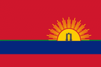
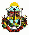
Carabobo State (Estado Carabobo, ) is one of the 23 states of Venezuela, located in the north of the country, about two hours by car from Caracas. The state capital city is Valencia, which is also the country's main industrial center. The state's area is 4,369 km2 and as of the 2011 census, had a population of 2,245,744. Carabobo State was the site of the Battle of Carabobo on 24 June 1821. This was a decisive win in the war of independence from Spain, and was led by Simón Bolívar.

There are several versions about the origin of the name Carabobo. One of them refers to a voice coming from a local Arawaco language: Karau means savannah and bo means water. The repeated bo acts as a superlative, i.e. a lot of water or streams. Thus, Carabobo would mean Savannah of Waters or Savannah of Ravines.
 
Map - Carabobo (Estado Carabobo)
Map
Google Earth - Map - Carabobo
Google Earth
Openstreetmap - Map - Carabobo
Openstreetmap
Map - Carabobo - Esri.WorldImagery
Esri.WorldImagery
Map - Carabobo - Esri.WorldStreetMap
Esri.WorldStreetMap
Map - Carabobo - OpenStreetMap.Mapnik
OpenStreetMap.Mapnik
Map - Carabobo - OpenStreetMap.HOT
OpenStreetMap.HOT
Map - Carabobo - OpenTopoMap
OpenTopoMap
Map - Carabobo - CartoDB.Positron
CartoDB.Positron
Map - Carabobo - CartoDB.Voyager
CartoDB.Voyager
Map - Carabobo - OpenMapSurfer.Roads
OpenMapSurfer.Roads
Map - Carabobo - Esri.WorldTopoMap
Esri.WorldTopoMap
Map - Carabobo - Stamen.TonerLite
Stamen.TonerLite
Country - Venezuela
Currency / Language  
ISO Currency Symbol Significant figures
VES Venezuelan bolívar BsS. or Bs. 2
ISO Language
ES Spanish language
Neighbourhood - Country  
  •  Brazil 
  •  Colombia 
  •  Guyana