Central Province (Medhu Sarahahdhu)
Central Province was one of the seven provinces of the Maldives. The provinces were created in a decentralization attempt by the Nasheed administration in 2008. It was governed by the Minister of State for Home Affairs, Ms. Thilmeeza Hussain. Rejecting this change, the Parliament saw the abolition of the province system in 2010, through a newly enacted Decentralization Act. It consisted of Dhaalu, Faafu and Meemu Atolls. Its capital was Kudahuvadhoo. Its population (2006 census) was 13,442.
Map - Central Province (Medhu Sarahahdhu)
Map


Country - Maldives
 |
 |
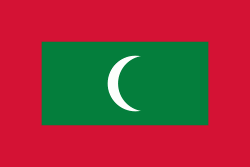
| Flag of Maldives | |
Comprising a territory spanning roughly 90,000 km2 including the sea, land area of all the islands comprises 298 km2, the Maldives is one of the world's most geographically dispersed sovereign states and the smallest Asian country as well as one of the smallest Muslim-majority countries by land area and, with around 557,751 inhabitants, the 2nd least populous country in Asia. Malé is the capital and the most populated city, traditionally called the "King's Island" where the ancient royal dynasties ruled for its central location.
Currency / Language
| ISO | Currency | Symbol | Significant figures |
|---|---|---|---|
| MVR | Maldivian rufiyaa | Þƒ | 2 |
| ISO | Language |
|---|---|
| DV | Dhivehi language |
| EN | English language |