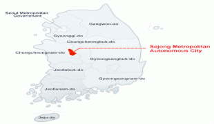
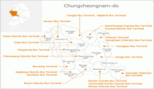
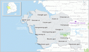
Chungcheongnam-do
 |
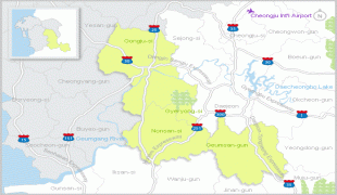
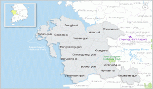
Hongseong County is the capital and Cheonan is the largest city of South Chungcheong, with other major cities including Asan, Seosan, and Dangjin. Daejeon was the largest city of South Chungcheong until becoming a Metropolitan City in 1989, and the historic capital until the provincial government was relocated to Hongseong in 2012.
South Chungcheong was established in 1896 from the province of Chungcheong, one of the Eight Provinces of Korea, consisting of the southwestern half of the territory. South Chungcheong was known as Chūsei-nan Prefecture during the Japanese Colonial Period from 1910 and became part of South Korea following the division of Korea in 1945.
Chungcheongnam-do is South Korea's richest province, with a 2012 GDP per capita of $56,133. It is by far South Korea's fastest growing region, with an average GDP growth of 9.7% in 2001-2007 that accelerated to 12.4% in 2010. Such rapid growth transformed it from a mostly agricultural to a highly industrialized economy in the 21st century.
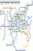
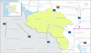
Along with Gangwon, Chungnam is the only province outside the Seoul Capital Area to be served by the Seoul Metropolitan Subway, with Seoul Subway Line 1 passing Cheonan and Asan. Multimillion-dollar projects are being developed, such as New Asan City centered on the newly built Cheonan-Asan Station that connects Chungnam's largest city, Cheonan, to Seoul Station in less than 30 minutes via the KTX bullet train.
The area code of the province is 041.
Map - Chungcheongnam-do
Map


Country - South_Korea
 |
 |
| Flag of South Korea | |
The Korean Peninsula was inhabited as early as the Lower Paleolithic period. Its first kingdom was noted in Chinese records in the early 7th century BCE. Following the unification of the Three Kingdoms of Korea into Silla and Balhae in the late 7th century, Korea was ruled by the Goryeo dynasty (918–1392) and the Joseon dynasty (1392–1897). The succeeding Korean Empire (1897–1910) was annexed in 1910 into the Empire of Japan. Japanese rule ended following Japan's surrender in World War II, after which Korea was divided into two zones; a northern zone occupied by the Soviet Union and a southern zone occupied by the United States. After negotiations on reunification failed, the southern zone became the Republic of Korea in August 1948 while the northern zone became the communist Democratic People's Republic of Korea the following month.
Currency / Language
| ISO | Currency | Symbol | Significant figures |
|---|---|---|---|
| KRW | South Korean won | â‚© | 0 |
| ISO | Language |
|---|---|
| EN | English language |
| KO | Korean language |


