Codrington Island (Codrington Island)
Codrington Island is a small uninhabited island off the north-east coast of Antigua.
Codrington Island lies on the north-east coast of Atlantic, in the Mercers Creek Bay in about 50 meters from the Antigua shore and approximately 100 meters of the town Rooms Estate, Pelican Island is located directly to north — two islands are connected to the mainland by the reefs. Crump Island is in the north-west. The cove which is detached from the Mercers Creek Bay by Codrington Island and lies to the south of island is called Lords Cove.
Codrington Island is about 400 meters long and maximum 300 meters wide with a bay in the west with a small companion islet there. It rises only a few meters above the sea level, is covered by tropical shrubland and has no beach.
Map - Codrington Island (Codrington Island)
Map
Country - Antigua_and_Barbuda
 |
 |
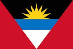
| Flag of Antigua and Barbuda | |
The country consists of two major islands, Antigua and Barbuda, which are approximately 40 km apart, and several smaller islands, including Great Bird, Green, Guiana, Long, Maiden, Prickly Pear, York, and Redonda. The permanent population is approximately 97,120 ( estimates), with 97% residing in Antigua. St. John's, Antigua, is the country's capital, major city, and largest port. Codrington is Barbuda's largest town.
Currency / Language
| ISO | Currency | Symbol | Significant figures |
|---|---|---|---|
| XCD | East Caribbean dollar | $ | 2 |
| ISO | Language |
|---|---|
| EN | English language |


