Copperbelt Province (Copperbelt Province)
Copperbelt Province is a province in Zambia which covers the mineral-rich Copperbelt, and farming and bush areas to the south. It was the backbone of the Northern Rhodesian economy during British colonial rule and fuelled the hopes of the immediate post-independence period, but its economic importance was severely damaged by a crash in global copper prices in 1973. The province adjoins the Haut-Katanga province of the Democratic Republic of the Congo, which is similarly mineral-rich.
The main cities of the Copperbelt are Kitwe, Ndola, Mufulira, Luanshya, Chingola, Kalulushi and Chililabombwe. Roads and rail links extend north into the Congo to Lubumbashi, but the Second Congo War brought economic contact between the two countries to a standstill, now recovering.
It is informally referred to at times as 'Copala' or 'Kopala', invoking the vernacular-like term of the mineral copper that is mined in the province.
As per the 2010 Zambian census, Copperbelt Province had a population of 1,972,317 accounting to 15.21% of the total Zambian population of 13,092,666. There were 981,887 males and 990,430 females, making the sex ratio to 1,009 for every 1,000 males, compared to the national average of 1,028. The literacy rate stood at 83.10% against a national average of 70.2%. The rural population constituted 19.11%, while the urban population was 80.89%. The total area of the province was 31,328 km2 and the population density was 63.00 per km2. The population density during 2000 Zambian census stood at 63.00. The decadal population growth of the province was 2.20%. The median age in the province at the time of marriage was 21.7. The average household size was 5.3, with the families headed by females being 4.8 and 5.5 for families headed by men. The total eligible voters in the province was 66.10%. The unemployment rate of the province was 22.10%. The total fertility rate was 5.0, complete birth rate was 5.8, crude birth rate was 29.0, child women population at birth was 587, general fertility rate was 112, gross reproduction rate was 1.8 and net reproduction rate was 1.7. The total labour force constituted 50.40% of the total population. Out of the labour force, 63.2% were men and 37.7% women. The annual growth rate of labour force was 2.7%. Bemba was the most spoken language with 83.90% speaking it. The total population in the province with albinism stood at 2,912. The life expectancy at birth stood at 54 compared to the national average of 51.
Map - Copperbelt Province (Copperbelt Province)
Map
Country - Zambia
 |
 |
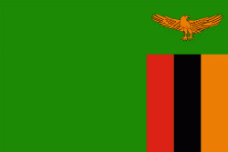
| Flag of Zambia | |
The region was affected by the Bantu expansion of the 13th century. Following the arrival of European explorers in the 18th century, the British colonised the region into the British protectorates of Barotseland-North-Western Rhodesia and North-Eastern Rhodesia comprising 73 tribes, towards the end of the 19th century. These were merged in 1911 to form Northern Rhodesia. For most of the colonial period, Zambia was governed by an administration appointed from London with the advice of the British South Africa Company. On 24 October 1964, Zambia became independent of the United Kingdom and prime minister Kenneth Kaunda became the inaugural president. From 1972 to 1991 Zambia was a one-party state with the United National Independence Party as the sole legal political party under the motto "One Zambia, One Nation" coined by Kaunda. Kaunda was succeeded by Frederick Chiluba of the social-democratic Movement for Multi-Party Democracy in 1991, beginning a period of government decentralisation.
Currency / Language
| ISO | Currency | Symbol | Significant figures |
|---|---|---|---|
| ZMW | Zambian kwacha | ZK | 2 |
| ISO | Language |
|---|---|
| NY | Chichewa language |
| EN | English language |


