Dayuan (Dayuan District)
Dayuan District, formerly known as Dayuan Township is a coastal district in northwestern Taoyuan City, Taiwan.
Dayuan District was originally named Toa-khu-hng, literally means a vast (大) vegetable garden (坵園) as an old Chinese name). In the earlier days, cottage scattered around the district with very limited settlers that grows vegetable and sweet potatoes. Hoklo people migrated to the area during the rule of Kangxi. In avoidance of the invasion of Yue people, walled villages were built around the settlements of Hoklo people. It was renamed Ōsono Village (大園庄) during Japanese rule, and was part of Tōen District, Shinchiku Prefecture. After the handover of Taiwan from Japan to the Republic of China, it was called Dayuan Township. It became Dayuan District in 2014, when Taoyuan County became a special municipality (and the former city of Taoyuan became a district of the special municipality).
Dayuan District was originally named Toa-khu-hng, literally means a vast (大) vegetable garden (坵園) as an old Chinese name). In the earlier days, cottage scattered around the district with very limited settlers that grows vegetable and sweet potatoes. Hoklo people migrated to the area during the rule of Kangxi. In avoidance of the invasion of Yue people, walled villages were built around the settlements of Hoklo people. It was renamed Ōsono Village (大園庄) during Japanese rule, and was part of Tōen District, Shinchiku Prefecture. After the handover of Taiwan from Japan to the Republic of China, it was called Dayuan Township. It became Dayuan District in 2014, when Taoyuan County became a special municipality (and the former city of Taoyuan became a district of the special municipality).
Map - Dayuan (Dayuan District)
Map
Country - Taiwan
 |
 |
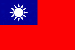
| Flag of Taiwan | |
* in East Asia. It is located at the junction of the East and South China Seas in the northwestern Pacific Ocean, with the People's Republic of China (PRC) to the northwest, Japan to the northeast, and the Philippines to the south. The territories controlled by the ROC consist of 168 islands, with a combined area of 36193 km2. The main island of Taiwan, also known as Formosa, has an area of 35,808 km2, with mountain ranges dominating the eastern two-thirds and plains in the western third, where its highly urbanised population is concentrated. The capital, Taipei, forms along with New Taipei City and Keelung the largest metropolitan area of Taiwan. Other major cities include Taoyuan, Taichung, Tainan, and Kaohsiung. With around 23.9 million inhabitants, Taiwan is among the most densely populated countries in the world.
Currency / Language
| ISO | Currency | Symbol | Significant figures |
|---|---|---|---|
| TWD | New Taiwan dollar | $ | 2 |
| ISO | Language |
|---|---|
| ZH | Chinese language |


