Map - East End

East End
 
Map - East End
Map
Google Earth - Map - East End
Google Earth
Openstreetmap - Map - East End
Openstreetmap
Map - East End - Esri.WorldImagery
Esri.WorldImagery
Map - East End - Esri.WorldStreetMap
Esri.WorldStreetMap
Map - East End - OpenStreetMap.Mapnik
OpenStreetMap.Mapnik
Map - East End - OpenStreetMap.HOT
OpenStreetMap.HOT
Map - East End - OpenTopoMap
OpenTopoMap
Map - East End - CartoDB.Positron
CartoDB.Positron
Map - East End - CartoDB.Voyager
CartoDB.Voyager
Map - East End - OpenMapSurfer.Roads
OpenMapSurfer.Roads
Map - East End - Esri.WorldTopoMap
Esri.WorldTopoMap
Map - East End - Stamen.TonerLite
Stamen.TonerLite
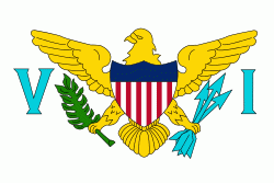
Country - United_States_Virgin_Islands
The United States Virgin Islands, officially the Virgin Islands of the United States, are a group of Caribbean islands and an unincorporated and organized territory of the United States. The islands are geographically part of the Virgin Islands archipelago and are located in the Leeward Islands of the Lesser Antilles to the east of Puerto Rico and west of the British Virgin Islands.

The U.S. Virgin Islands consist of the main islands of Saint Croix, Saint John, and Saint Thomas and 50 other surrounding minor islands and cays. The total land area of the territory is 133.73 sqmi. The territory's capital is Charlotte Amalie on the island of St. Thomas.
Currency / Language  
ISO Currency Symbol Significant figures
USD United States dollar $ 2
ISO Language
EN English language
Neighbourhood - Country  
Language