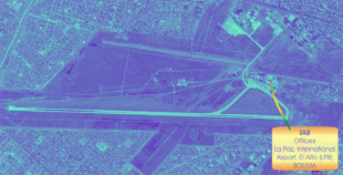
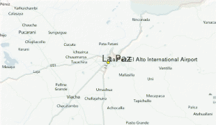
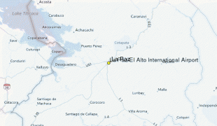
El Alto International Airport (El Alto International Airport)
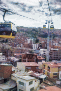
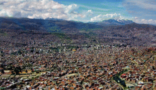
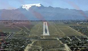
El Alto International Airport (Aeropuerto Internacional El Alto) is an international airport serving La Paz, Bolivia. It is located in the city of El Alto, 8 mi west of La Paz. At an elevation of 4061.5 m, it is the highest international airport, the sixth highest commercial airport in the world and the highest commercial airport outside of China.
The airport has been in service since the first half of the 20th century, but was modernized in the late 1960s, when its runway was lengthened and a new passenger terminal with modern facilities was built. The new airport was inaugurated in 1965. El Alto airport was a primary hub for the former Lloyd Aéreo Boliviano, Bolivia's flag carrier which ceased operations in 2007 and is a hub for Línea Aérea Amaszonas. It serves also as a focus city for Boliviana de Aviación which is a state-owned airline.
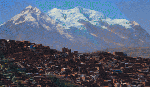
Bolivia is characterized by an extremely varied terrain including rugged mountains, high plateaus, low valleys and tropical forests; this topography has had a negative effect on national transportation, making communication difficult between elevated and low cities along with isolated tropical towns. Aviation is an important solution for isolated communities in this environment.
Bolivian air transport started in 1916, when the Military school of Aviation (Escuela Militar de Aviación) was formed in La Paz. In 1929 the local La Paz Government first planned the construction of an airport. However it was not officially inaugurated until the 1960s. In 1974 the airport was reconstructed, a new terminal was built and its facilities were enlarged and modernized. Until 1999 the airport had John F. Kennedy (JFK) as its official name although in practice this name was never publicly used. In that year, before the pressure of different sectors, by means of the Law 1944 during the government of Hugo Banzer Suárez the airport changed its name officially to El Alto International Airport.
The airport has been in service since the first half of the 20th century, but was modernized in the late 1960s, when its runway was lengthened and a new passenger terminal with modern facilities was built. The new airport was inaugurated in 1965. El Alto airport was a primary hub for the former Lloyd Aéreo Boliviano, Bolivia's flag carrier which ceased operations in 2007 and is a hub for Línea Aérea Amaszonas. It serves also as a focus city for Boliviana de Aviación which is a state-owned airline.
Bolivia is characterized by an extremely varied terrain including rugged mountains, high plateaus, low valleys and tropical forests; this topography has had a negative effect on national transportation, making communication difficult between elevated and low cities along with isolated tropical towns. Aviation is an important solution for isolated communities in this environment.
Bolivian air transport started in 1916, when the Military school of Aviation (Escuela Militar de Aviación) was formed in La Paz. In 1929 the local La Paz Government first planned the construction of an airport. However it was not officially inaugurated until the 1960s. In 1974 the airport was reconstructed, a new terminal was built and its facilities were enlarged and modernized. Until 1999 the airport had John F. Kennedy (JFK) as its official name although in practice this name was never publicly used. In that year, before the pressure of different sectors, by means of the Law 1944 during the government of Hugo Banzer Suárez the airport changed its name officially to El Alto International Airport.
| IATA Code | LPB | ICAO Code | SLLP | FAA Code | |
|---|---|---|---|---|---|
| Telephone | Fax | ||||
| Home page |
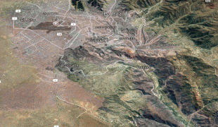
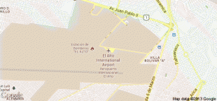
Map - El Alto International Airport (El Alto International Airport)
Map


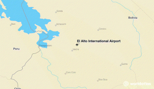
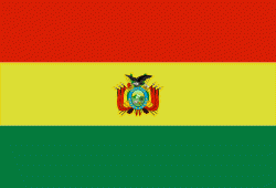
Country - Bolivia
 |
 |
| Flag of Bolivia | |
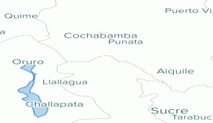
The sovereign state of Bolivia is a constitutionally unitary state, divided into nine departments. Its geography varies from the peaks of the Andes in the West, to the Eastern Lowlands, situated within the Amazon basin. One-third of the country is within the Andean mountain range. With 1098581 km2 of area, Bolivia is the fifth largest country in South America, after Brazil, Argentina, Peru, and Colombia (and alongside Paraguay, one of the only two landlocked countries in the Americas), the 27th largest in the world, the largest landlocked country in the Southern Hemisphere, and the world's seventh largest landlocked country, after Kazakhstan, Mongolia, Chad, Niger, Mali, and Ethiopia.
Currency / Language
| ISO | Currency | Symbol | Significant figures |
|---|---|---|---|
| BOB | Boliviano | Bs | 2 |
| ISO | Language |
|---|---|
| AY | Aymara language |
| QU | Quechua language |
| ES | Spanish language |