El Arish International Airport (El Arish International Airport)
El Arish International Airport (مطار العريش الدولي) is an airport near El Arish, Egypt. In 2011 the airport served 5,991 passengers (-45.4% vs. 2010).
The airport was the home base of Palestinian Airlines which ceased operations in December 2020. In May 2012, the company restarted two-weekly flights to Amman, with flights to Jeddah, Saudi Arabia to follow soon. It is one of the closest airports to the Gaza Strip; El Gora Airport is slightly closer but has no scheduled air service. Palestinian Airlines relocated to El Arish International Airport after Yasser Arafat International Airport was rendered non-operational when the runway was destroyed by Israeli forces in 2001. The airport has been mainly used for Palestinian passengers from the Gaza Strip traveling to Jeddah, Saudi Arabia for the annual Hajj Muslim pilgrimage.
The airport was the home base of Palestinian Airlines which ceased operations in December 2020. In May 2012, the company restarted two-weekly flights to Amman, with flights to Jeddah, Saudi Arabia to follow soon. It is one of the closest airports to the Gaza Strip; El Gora Airport is slightly closer but has no scheduled air service. Palestinian Airlines relocated to El Arish International Airport after Yasser Arafat International Airport was rendered non-operational when the runway was destroyed by Israeli forces in 2001. The airport has been mainly used for Palestinian passengers from the Gaza Strip traveling to Jeddah, Saudi Arabia for the annual Hajj Muslim pilgrimage.
| IATA Code | AAC | ICAO Code | HEAR | FAA Code | |
|---|---|---|---|---|---|
| Telephone | Fax | ||||
| Home page |
Map - El Arish International Airport (El Arish International Airport)
Map


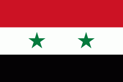
Country - United_Arab_Republic
 |
 |
| Flag of Egypt | |
The republic was led by Egyptian President Gamal Abdel Nasser. The UAR was a member of the United Arab States, a loose confederation with the Mutawakkilite Kingdom of Yemen, which was dissolved in 1961.
Currency / Language
| ISO | Currency | Symbol | Significant figures |
|---|---|---|---|
| EGP | Egyptian pound | £ or جم | 2 |
| ISO | Language |
|---|---|
| AR | Arabic language |
| EN | English language |
| FR | French language |