Escuintla (Departamento de Escuintla)
 |
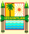 |
In 2002 the city had a population of 86,678. It is located on the border of the central highlands and the Pacific coastal plain.
Many of the names of the municipalities of Guatemala consist of one of two things: the name of a catholic saint to worship the day the city was founded or a description with Náhuatl roots. These influences are due to the troops in command of Pedro de Alvarado who invaded the region in 1520. These troops were composed of Spanish soldiers and indigenous Tlaxcaltecs.
The name Escuintla, comes from the indigenous language nahuatl «Itzcuintlán», which is a word composed of two words:
· «Itzcuintli»: means “dog”
· «tlan»: means “abundance”
Therefore, Escuintla means “abundance or place of dogs”.
Map - Escuintla (Departamento de Escuintla)
Map


Country - Guatemala

Currency / Language
| ISO | Currency | Symbol | Significant figures |
|---|---|---|---|
| GTQ | Guatemalan quetzal | Q | 2 |
| ISO | Language |
|---|---|
| ES | Spanish language |

