Porto Airport (Francisco de Sá Carneiro Airport)
Francisco Sá Carneiro Airport or simply Porto Airport (formerly Pedras Rubras Airport) is an international airport near Porto (Oporto), Portugal. It is located 11 km northwest of the Clérigos Tower in the centre of Porto, in the municipalities of Maia, Matosinhos and Vila do Conde and is run by ANA – Aeroportos de Portugal. The airport is currently the second-busiest in the country, based on aircraft operations; and the second-busiest in passengers, based on Aeroportos de Portugal traffic statistics, after Lisbon Airport and before Faro Airport. The airport is a base for easyJet, Ryanair, TAP Air Portugal and its subsidiary TAP Express.
The airport is surrounded by the municipalities of Matosinhos (to the south and west) and Vila do Conde (to the north) and Maia (to the east). It covers the parishes of Santa Cruz do Bispo, Perafita and Lavra (in Matosinhos); Aveleda and Vilar do Pinheiro (Vila do Conde); and Vila Nova da Telha and Moreira (Maia). It includes an area of between 72 m in the extreme south and 43 m in the north. The southern portion of the airport intersects the hydrographic watershed of the Leça River, while the north is crossed by effluents of Onda River.
The airport is surrounded by the municipalities of Matosinhos (to the south and west) and Vila do Conde (to the north) and Maia (to the east). It covers the parishes of Santa Cruz do Bispo, Perafita and Lavra (in Matosinhos); Aveleda and Vilar do Pinheiro (Vila do Conde); and Vila Nova da Telha and Moreira (Maia). It includes an area of between 72 m in the extreme south and 43 m in the north. The southern portion of the airport intersects the hydrographic watershed of the Leça River, while the north is crossed by effluents of Onda River.
Map - Porto Airport (Francisco de Sá Carneiro Airport)
Map
Country - Portugal
 |
 |
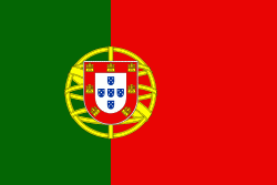
| Flag of Portugal | |
One of the oldest countries in Europe, its territory has been continuously settled, invaded and fought over since prehistoric times. The territory was first inhabited by pre-Roman and Celtic peoples who had contact with Phoenicians, ancient Greeks and Carthaginians. It was later ruled by the Romans, followed by the invasions of Germanic peoples and the Islamic invasion by the Moors, whose rule was eventually expelled during the Reconquista. Founded first as a county of the Kingdom of León in 868, gained its independence as the Kingdom of Portugal with the Treaty of Zamora in 1143.
Currency / Language
| ISO | Currency | Symbol | Significant figures |
|---|---|---|---|
| EUR | Euro | € | 2 |
| ISO | Language |
|---|---|
| PT | Portuguese language |


