Funafuti International Airport (Funafuti International Airport)
Funafuti International Airport is an airport in Funafuti, in the capital city of the island nation of Tuvalu. It is the sole international airport in Tuvalu. Fiji Airways operates between Suva and Funafuti.
Funafuti Airport was built by a Seabee detachment of the 2nd Naval Construction Battalion of the United States Navy in 1943 during World War II.
The military airfield included an airstrip, control tower and facilities, with a radio station at Tepuka, connected by cable to the airfield. The base headquarters buildings were at the present-day Teagai Apelu's residence, and a bunker is there to this day.
The first offensive operation was launched on 20 April 1943 when 22 B-24 Liberator aircraft from 371 and 372 Bombardment Squadrons bombed Nauru. The next day the Japanese made a predawn raid on the strip at Funafuti that destroyed one B-24 and caused damage to five other planes. On 22 April, 12 B-24 aircraft bombed Tarawa. Marine Fighting Squadron 441 (VMF-441), flying the F4F Wildcat, operated from Funafuti from May to September 1943.
The airfield became the headquarters of the United States Army Air Forces VII Bomber Command in November 1943, which directed operations against Japanese forces on Tarawa and other bases in the Gilbert Islands. The USAAF stationed two B-24 Liberator heavy bomber groups, the 11th Wing and 30th Bombardment Groups on Funafuti in the implementation of Operation Galvanic, which led to the Battle of Tarawa and the Battle of Makin in November 1943.
By the middle of 1944, as the fighting moved further north toward Japan, the Americans began to withdraw. By the time the Pacific War ended in 1945, nearly all of them, with their equipment, departed. After the war, the military airfield was developed into a commercial airport.
| IATA Code | FUN | ICAO Code | NGFU | FAA Code | |
|---|---|---|---|---|---|
| Telephone | Fax | ||||
| Home page |
Map - Funafuti International Airport (Funafuti International Airport)
Map
Country - Tuvalu
 |
 |
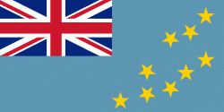
| Flag of Tuvalu | |
The first inhabitants of Tuvalu were Polynesians, according to well-established theories regarding a migration of Polynesians into the Pacific that began about three thousand years ago. Long before European contact with the Pacific islands, Polynesians frequently voyaged by canoe between the islands. Polynesian navigation skills enabled them to make elaborately planned journeys in either double-hulled sailing canoes or outrigger canoes. Scholars believe that the Polynesians spread out from Samoa and Tonga into the Tuvaluan atolls, which then served as a stepping stone for further migration into the Polynesian outliers in Melanesia and Micronesia.
Currency / Language
| ISO | Currency | Symbol | Significant figures |
|---|---|---|---|
| AUD | Australian dollar | $ | 2 |
| ISO | Language |
|---|---|
| EN | English language |
| SM | Samoan language |


