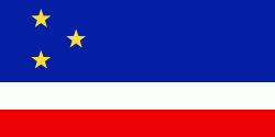
Gagauzia (Găgăuzia)
 |
 |
At the end of World War I, all of the territory of Gagauzia became part of the Kingdom of Romania, before being carved up into the Soviet Union in June 1940. From 1941 to 1944 it was again part of Romania, after which it was incorporated into the Moldavian Soviet Socialist Republic. As the Soviet Union began to disintegrate, Gagauzia declared independence in 1990 as the Gagauz Republic, but was integrated into Moldova in 1994.
Gagauz Yeri literally means "place of the Gagauz".
The origin of the Gagauz is obscure. In the beginning of the 20th century, Bulgarian historian M. Dimitrov counted 19 different theories about their origin. A few decades later, the Gagauz ethnologist M. N. Guboglo increased that number to 21. In some of those theories the Gagauz are presented as descendants of the Bulgars, the Cumans-Kipchaks, or a clan of Seljuk Turks led by a Turkoman dervish, Sarı Saltık. The fact that their confession is Eastern Orthodox Christianity may suggest that their ancestors already lived in the Balkans prior to the Ottoman conquest in the late 14th century. Another theory indicates that Gagauz are descendants of Kutrigurs. In the official Gagauz museum, a plaque mentions that one of the two main theories is that they descend from the Bulgars.
Map - Gagauzia (Găgăuzia)
Map


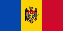
Country - Moldova
 |
 |
| Flag of Moldova | |
Most of Moldovan territory was a part of the Principality of Moldavia from the 14th century until 1812, when it was ceded to the Russian Empire by the Ottoman Empire (to which Moldavia was a vassal state) and became known as Bessarabia. In 1856, southern Bessarabia was returned to Moldavia, which three years later united with Wallachia to form Romania, but Russian rule was restored over the whole of the region in 1878. During the 1917 Russian Revolution, Bessarabia briefly became an autonomous state within the Russian Republic. In February 1918, it declared independence and then integrated into Romania later that year following a vote of its assembly. The decision was disputed by Soviet Russia, which in 1924 established, within the Ukrainian SSR, a so-called Moldavian autonomous republic on partially Moldovan-inhabited territories to the east of Bessarabia.
Currency / Language
| ISO | Currency | Symbol | Significant figures |
|---|---|---|---|
| MDL | Moldovan leu | L | 2 |
| ISO | Language |
|---|---|
| RO | Romanian language |
| RU | Russian language |
| TR | Turkish language |
