Gibraltar
 |
 |
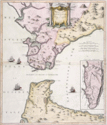
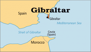
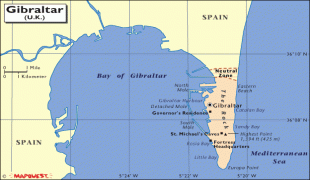
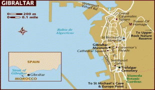
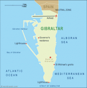
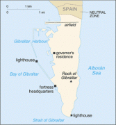
In 1704, Anglo-Dutch forces captured Gibraltar from Spain during the War of the Spanish Succession. The territory was ceded to Great Britain in perpetuity under the Treaty of Utrecht in 1713. It became an important base for the Royal Navy, particularly during the Napoleonic Wars and World War II, as it controlled the narrow entrance and exit to the Mediterranean Sea, the Strait of Gibraltar, which is only 8.9 mi wide. This choke point remains strategically important, with half the world's seaborne trade passing through it. Gibraltar's economy is based largely on tourism, online gambling, financial services, and bunkering.
The sovereignty of Gibraltar is a point of contention in Anglo-Spanish relations, as Spain asserts a claim to the territory. Gibraltarians overwhelmingly rejected proposals for Spanish sovereignty in a 1967 referendum, and for shared sovereignty in a 2002 referendum. Nevertheless, Gibraltar maintains close economic and cultural links with Spain, with many Gibraltarians speaking Spanish as well as a local dialect known as Llanito.
On 31 January 2020, the UK and Gibraltar left the European Union. In December 2020, the UK and Spain agreed in principle to a basis on which the UK and the EU might negotiate terms for Gibraltar to participate in aspects of the Schengen Agreement to facilitate border movements.
The name is derived from جبل طارق (named after the 8th-century Moorish military leader Tariq ibn Ziyad). That continues to be its name in Arabic. It has also been suggested that the name is a contraction of the جبل على الطريق jabal alā aṭ-ṭarīq ('mountain on the way').
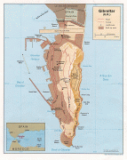
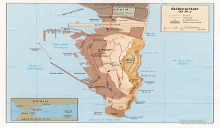
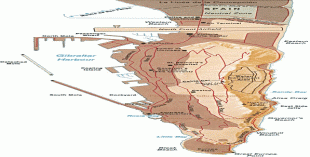
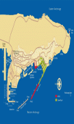
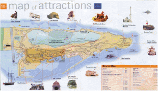
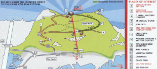
Map - Gibraltar
Map


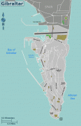

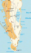
Country - Gibraltar
 |
 |
In 1704, Anglo-Dutch forces captured Gibraltar from Spain during the War of the Spanish Succession. The territory was ceded to Great Britain in perpetuity under the Treaty of Utrecht in 1713. It became an important base for the Royal Navy, particularly during the Napoleonic Wars and World War II, as it controlled the narrow entrance and exit to the Mediterranean Sea, the Strait of Gibraltar, which is only 8.9 mi wide. This choke point remains strategically important, with half the world's seaborne trade passing through it. Gibraltar's economy is based largely on tourism, online gambling, financial services, and bunkering.
Currency / Language
| ISO | Currency | Symbol | Significant figures |
|---|---|---|---|
| GIP | Gibraltar pound | £ | 2 |
| ISO | Language |
|---|---|
| EN | English language |
| IT | Italian language |
| PT | Portuguese language |
| ES | Spanish language |