Map - Gilbert Islands

Gilbert Islands
 
Map - Gilbert Islands
Map
Google Earth - Map - Gilbert Islands
Google Earth
Openstreetmap - Map - Gilbert Islands
Openstreetmap
Map - Gilbert Islands - Esri.WorldImagery
Esri.WorldImagery
Map - Gilbert Islands - Esri.WorldStreetMap
Esri.WorldStreetMap
Map - Gilbert Islands - OpenStreetMap.Mapnik
OpenStreetMap.Mapnik
Map - Gilbert Islands - OpenStreetMap.HOT
OpenStreetMap.HOT
Map - Gilbert Islands - OpenTopoMap
OpenTopoMap
Map - Gilbert Islands - CartoDB.Positron
CartoDB.Positron
Map - Gilbert Islands - CartoDB.Voyager
CartoDB.Voyager
Map - Gilbert Islands - OpenMapSurfer.Roads
OpenMapSurfer.Roads
Map - Gilbert Islands - Esri.WorldTopoMap
Esri.WorldTopoMap
Map - Gilbert Islands - Stamen.TonerLite
Stamen.TonerLite
Country - Kiribati
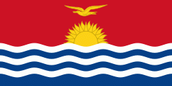
Flag of Kiribati
Kiribati, officially the Republic of Kiribati ([Ribaberiki] Kiribati), is an island country in Oceania in the Central Pacific Ocean. Its permanent population is over 119,000 (2020), with more than half living on Tarawa atoll. The state comprises 32 atolls and one remote raised coral island, Banaba. Its total land area is 811 km2 dispersed over 3441810 km2 of ocean.

The islands' spread straddles the equator and the 180th meridian, although the International Date Line goes around Kiribati and swings far to the east, almost reaching 150°W. This brings Kiribati's easternmost islands, the southern Line Islands south of Hawaii, into the same day as the Gilbert Islands and places them in the most advanced time zone on Earth: UTC+14.
Currency / Language  
ISO Currency Symbol Significant figures
AUD Australian dollar $ 2
ISO Language
EN English language
Neighbourhood - Country  
Administrative Subdivision
Country, State, Region,...