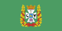
Gomel Region (Homyel’ Voblasc’)
 |
 |
The total area of the region is 40400 km2, the population in 2011 stood at 1,435,000 with the number of inhabitants per km2 at 36.
Important cities within the region include: Homiel, Mazyr, Zhlobin, Svietlahorsk, Rechytsa, Kalinkavichy, Rahachow and Dobrush.
Both the Gomel Region and the Mogilev Region suffered severely from the Chernobyl disaster. The Gomel Province borders the Chernobyl Exclusion Zone in places, and parts of it have been designated as mandatory or voluntary resettlement areas as a result of the radioactive contamination.
Gomel Region comprises 21 districts and 2 city municipalities. The districts have 278 selsovets, and 17 cities and towns.
Map - Gomel Region (Homyel’ Voblasc’)
Map


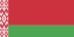
Country - Belarus
 |
 |
| Flag of Belarus | |
Until the 20th century, different states at various times controlled the lands of modern-day Belarus, including Kievan Rus', the Principality of Polotsk, the Grand Duchy of Lithuania, the Polish–Lithuanian Commonwealth, and the Russian Empire. In the aftermath of the Russian Revolution in 1917, different states arose competing for legitimacy amid the Civil War, ultimately ending in the rise of the Byelorussian SSR, which became a founding constituent republic of the Soviet Union in 1922. After the Polish-Soviet War, Belarus lost almost half of its territory to Poland. Much of the borders of Belarus took their modern shape in 1939, when some lands of the Second Polish Republic were reintegrated into it after the Soviet invasion of Poland, and were finalized after World War II. During World War II, military operations devastated Belarus, which lost about a quarter of its population and half of its economic resources. The republic was redeveloped in the post-war years. In 1945, the Byelorussian SSR became a founding member of the United Nations, along with the Soviet Union.
Currency / Language
| ISO | Currency | Symbol | Significant figures |
|---|---|---|---|
| BYN | Belarusian ruble | Br | 2 |
| ISO | Language |
|---|---|
| BE | Belarusian language |
| RU | Russian language |


