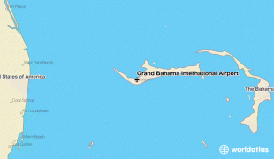
Grand Bahama International Airport (Grand Bahama International Airport)
Grand Bahama International Airport (GBIA) is an international airport in Freeport, Bahamas. It was privately owned until the government of the Bahamas purchased it in April 2021.
The airport was a joint venture between Hutchison Port Holdings (HPH) and The Port Group (or the Grand Bahama Port Authority). The facility also includes 741 acre of land that adjoins it to the Freeport Harbour Company Limited as they operate as one entity, known as the Sea Air Business Centre (SABC).
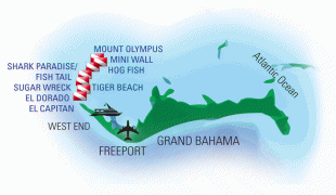
The airport has a 3359 x runway which is capable of handling the largest aircraft in service and is relatively close to all major cities of the Eastern Seaboard of the United States.
Some other features that are available at the Grand Bahama International Airport are:
* 1) VOR system
* 2) PAPI (Precision approach path indicator) system
* 3) Distance-remaining markers
* 4) Category seven fire fighting facilities
* 5) General aviation services
* 6) Air conditioned passenger terminal (Set temp: 28 degrees C)
The airport was a joint venture between Hutchison Port Holdings (HPH) and The Port Group (or the Grand Bahama Port Authority). The facility also includes 741 acre of land that adjoins it to the Freeport Harbour Company Limited as they operate as one entity, known as the Sea Air Business Centre (SABC).
The airport has a 3359 x runway which is capable of handling the largest aircraft in service and is relatively close to all major cities of the Eastern Seaboard of the United States.
Some other features that are available at the Grand Bahama International Airport are:
* 1) VOR system
* 2) PAPI (Precision approach path indicator) system
* 3) Distance-remaining markers
* 4) Category seven fire fighting facilities
* 5) General aviation services
* 6) Air conditioned passenger terminal (Set temp: 28 degrees C)
| IATA Code | FPO | ICAO Code | MYGF | FAA Code | |
|---|---|---|---|---|---|
| Telephone | (242) 352-6020 | Fax | (242) 352-9432 | ||
| Home page |
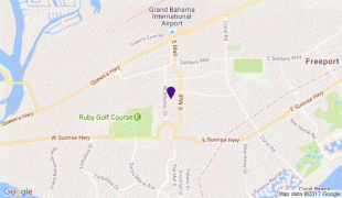
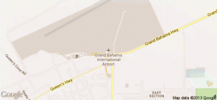
Map - Grand Bahama International Airport (Grand Bahama International Airport)
Map


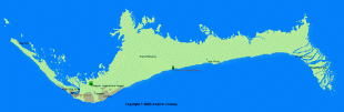


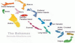
Country - The_Bahamas
 |
 |
The Bahama Islands were inhabited by the Lucayans, a branch of the Arawakan-speaking Taíno, for many centuries. Christopher Columbus was the first European to see the islands, making his first landfall in the "New World" in 1492 when he landed on the island of San Salvador. Later, the Spanish shipped the native Lucayans to and enslaved them on Hispaniola, after which the Bahama islands were mostly deserted from 1513 until 1648, nearly all native Bahamians having been forcibly removed for enslavement or having died of diseases that Europeans brought to the islands. In 1649, English colonists from Bermuda, known as the Eleutheran Adventurers, settled on the island of Eleuthera.
Currency / Language
| ISO | Currency | Symbol | Significant figures |
|---|---|---|---|
| BSD | Bahamian dollar | $ | 2 |
| ISO | Language |
|---|---|
| EN | English language |