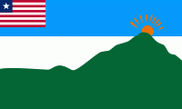
Grand Gedeh is a county in the eastern portion of the West African nation of Liberia. One of 15 counties that constitute the first-level of administrative division in the nation, it has three districts. Zwedru (formerly Tchien) serves as the capital with the area of the county. Measuring 10484 km2, it is larger than 28 independent countries including Lebanon, Trinidad and Tobago, Cape Verde, Malta and Mauritius and the combined area of the US states of Delaware and Rhode Island. As of the 2008 Census, it had a population of 126,146, making it the ninth most populous county in Liberia. Grand Gedeh has lower tropical forests which has mid size hills composed of various valleys and water courses. These forests receive a very high rainfall ranging from 3000 mm to 4100 mm per year.
Grand Gedeh's County Superintendent is Kai Farley. The county is bordered by Nimba County to the west, Sinoe County to the southwest, and River Gee County to the southeast. The northern part of Grand Gedeh borders the nation of Côte d'Ivoire.
Grand Chedah has lower tropical forests which has mid size hills composed of various valleys and water courses. These forests receive a very high rainfall ranging from 3000 mm to 4100 mm per year in two distinct seasons. It has evergreen forests. While in the uplands it is conducive for rice cultivation, the low lying areas are conducive for yam, cocoa, plantains, potatoes, vegetables, rubber, coffee and sugarcane. Grand Chedah county has two community forest, namely Neezonnie, occupying an area of 42424 ha and Blouquia, occupying an area of 43796 ha. There are three National plantation areas: the SIGA Reforestation project (247.2 ha), EAC Reforestation project (59.2 ha) and the WATRACE Reforestation project (58.4 ha). It also shares the National proposed reserve of Grebo Forest (97136 ha) with River Gee County.


