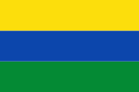
Guainía Department (Departamento del Guainía)
 |
 |
There are two municipalities in Guainía: Inírida, its capital, and Barranco Minas. The rest of the territory is subdivided in corregimientos departamentales, a pending figure due to public disorder. This case happens only in Amazonas, Vaupés and Vichada. Barranco Minas is the second biggest population and a municipality since 2019; it is located on the Guaviare River.
The Guainía corregimientos are:
* 1) Cacahual
* 2) La Guadalupe
* 3) Mapiripana
* 4) Morichal Nuevo
* 5) Pana Pana
* 6) Puerto Colombia
* 7) San Felipe
Map - Guainía Department (Departamento del Guainía)
Map


Country - Colombia


Currency / Language
| ISO | Currency | Symbol | Significant figures |
|---|---|---|---|
| COP | Colombian peso | $ | 2 |
| ISO | Language |
|---|---|
| ES | Spanish language |