Guilin Liangjiang International Airport (Guilin Liangjiang International Airport)
Guilin Liangjiang International Airport is the airport serving the city of Guilin in Guangxi Zhuang Autonomous Region, China. It is located in Liangjiang, about 28 km southwest of the city center.
In 2014, Guilin Liangjiang International Airport was the 33rd busiest airport in China with 5,875,327 passengers. Around 4 million passengers transit through Liangjiang Airport annually, traveling to one of the 48 domestic and international destinations served nonstop from Guilin.
In September 1991, the State Council of China and the Central Military Commission approved a 1.85 billion yuan project to build a new airport to replace Guilin Qifengling Airport as Guilin's civil airport. Construction began in July 1993, and Liangjiang Airport was opened on 1 October 1996.
Liangjiang Airport now features a 3,200 meter-long runway, a 150,000 square meter large parking apron, 20 gate positions, and a 50,000 square meter large terminal building. The airport has also invested 20 million yuan into improving Liangjiang International's aesthetics and making the airport more environmentally-friendly. The airport has received several awards for their efforts.
Starting from 30 September 2018, all flights from Terminal 1 have been moved to Terminal 2. Terminal 2 has a floor area of 100,000 square meters, 22 security lanes which 17 for domestic and 5 for International and 25 boarding gate, the designed capacity to handle 12 million passengers and 95,000 tons of cargo a year. The construction of Terminal 2 started in December 2015 and it was opened on September 30, 2018, at a total cost of 3.258 billion yuan. Following the opening of the new Terminal 2, Terminal 1 was closed temporarily for renovation. A new apron and taxi lanes have been built and opened along with the new terminal.
| IATA Code | KWL | ICAO Code | ZGKL | FAA Code | |
|---|---|---|---|---|---|
| Telephone | Fax | ||||
| Home page |
Map - Guilin Liangjiang International Airport (Guilin Liangjiang International Airport)
Map
Country - China
 |
 |
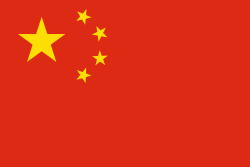
| Flag of China | |
Modern Chinese trace their origins to a cradle of civilization in the fertile basin of the Yellow River in the North China Plain. The semi-legendary Xia dynasty in the 21st century BCE and the well-attested Shang and Zhou dynasties developed a bureaucratic political system to serve hereditary monarchies, or dynasties. Chinese writing, Chinese classic literature, and the Hundred Schools of Thought emerged during this period and influenced China and its neighbors for centuries to come. In the third century BCE, Qin's wars of unification created the first Chinese empire, the short-lived Qin dynasty. The Qin was followed by the more stable Han dynasty (206 BCE–220 CE), which established a model for nearly two millennia in which the Chinese empire was one of the world's foremost economic powers. The empire expanded, fractured, and reunified; was conquered and reestablished; absorbed foreign religions and ideas; and made world-leading scientific advances, such as the Four Great Inventions: gunpowder, paper, the compass, and printing. After centuries of disunity following the fall of the Han, the Sui (581–618) and Tang (618–907) dynasties reunified the empire. The multi-ethnic Tang welcomed foreign trade and culture that came over the Silk Road and adapted Buddhism to Chinese needs. The early modern Song dynasty (960–1279) became increasingly urban and commercial. The civilian scholar-officials or literati used the examination system and the doctrines of Neo-Confucianism to replace the military aristocrats of earlier dynasties. The Mongol invasion established the Yuan dynasty in 1279, but the Ming dynasty (1368–1644) re-established Han Chinese control. The Manchu-led Qing dynasty nearly doubled the empire's territory and established a multi-ethnic state that was the basis of the modern Chinese nation, but suffered heavy losses to foreign imperialism in the 19th century.
Currency / Language
| ISO | Currency | Symbol | Significant figures |
|---|---|---|---|
| CNY | Renminbi | ¥ or 元 | 2 |
| ISO | Language |
|---|---|
| ZH | Chinese language |
| UG | Uighur language |
| ZA | Zhuang language |


