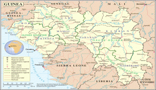
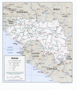
Guinea (Republic of Guinea)
 |
 |
| Flag of Guinea | |
Formerly French Guinea, it achieved independence in 1958. It has a history of military coups d'état. After decades of authoritarian rule, in 2010 it held its first democratic election. As it continued to hold multi-party elections, the country continued to face ethnic conflicts, corruption, and abuses by military and police. In 2011, the United States government claimed that torture by security forces and abuse of women and children (including female genital mutilation) were ongoing human rights issues. In 2021, a military faction overthrew president Alpha Condé and suspended the constitution.
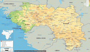
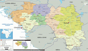
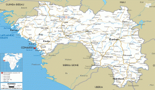
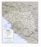
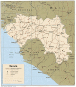
Muslims represent 85% of the population. The country is divided into four geographic regions: Maritime Guinea on the Atlantic coast, the Fouta Djallon or Middle Guinea highlands, the Upper Guinea savanna region in the northeast, and the Guinée forestière region of tropical forests. French, the official language of Guinea, is a language of communication in schools, in government administration, and the media. More than 24 indigenous languages are spoken and the largest are Susu, Pular, and Maninka, which dominate respectively in Maritime Guinea, Fouta Djallon, and Upper Guinea, while Guinée forestière is ethnolinguistically diverse. Guinea's economy is mostly dependent on agriculture and mineral production. It is the world's second largest producer of bauxite, and has deposits of diamonds and gold. The country was at the core of the 2014 Ebola outbreak.
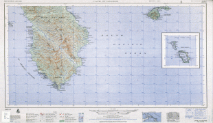
Guinea is named after the Guinea region which lies along the Gulf of Guinea. It stretches north through the forested tropical regions and ends at the Sahel. The English term Guinea comes directly from the Portuguese word Guiné which emerged in the mid-15th century to refer to the lands inhabited by the Guineus, a generic term for the black African peoples south of the Senegal River, in contrast to the "tawny" Zenaga Berbers above it, whom they called Azenegues or Moors.
Currency / Language
| ISO | Currency | Symbol | Significant figures |
|---|---|---|---|
| GNF | Guinean franc | Fr | 0 |
| ISO | Language |
|---|---|
| FR | French language |