Map - Hajdú-Bihar County (Hajdú-Bihar)

Hajdú-Bihar County (Hajdú-Bihar)
Hajdú-Bihar (Hajdú-Bihar vármegye, ) is an administrative county (comitatus or vármegye) in eastern Hungary, on the border with Romania. It shares borders with the Hungarian counties Szabolcs-Szatmár-Bereg, Borsod-Abaúj-Zemplén, Jász-Nagykun-Szolnok and Békés. The capital of Hajdú-Bihar county is Debrecen. Together with Bihor County in Romania it constitutes the Biharia Euroregion.

The area of the county does not form a geographical unit; it shares several features with the neighbouring areas: from northeast the sand hills of the Nyírség spread over the county borders. The western part is the Hortobágy National Park ("Puszta"), a large flat area of the country. The county of Hajdú-Bihar occupies the eastern part of Hungary. Most of its territory is completely flat and is part of the Pannonian Plain region (called the Grand Plain in the country). The highest point hardly rises over 170.5 metres in the north. It seems that the county slopes to the south because the lowest point is situated in this part of Hajdú-Bihar and hits the 85 metres height.

The wind and rivers formed and shaped the land for thousands of years. First the area of the present-day Hungary was occupied by an inland sea. Then, after some underground movement, the huge peaks of the Carpathians rose from this sea. The wild and rapid rivers of the mountains slowly made that inland sea disappear. Later, the great Hungarian plain was formed by the alluvial deposits of the rivers, the wind began to work and from the great rocks became smaller and smaller sand-grains, the so-called loess. This covers thickly the Hajdú-Bihar plain as well and makes a fertile soil. There are two great rivers in this area, the Tisza and the Körös. The Hortobágy area was formed by the first one. It used to be the flood area of the Tisza river and after the river was controlled, the Hortobágy became dry, resulting in special fauna.

 
Map - Hajdú-Bihar County (Hajdú-Bihar)
Country - Hungary
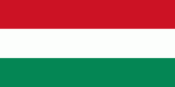
Flag of Hungary
Hungary (Magyarország ) is a landlocked country in Central Europe. Spanning 93030 km2 of the Carpathian Basin, it is bordered by Slovakia to the north, Ukraine to the northeast, Romania to the east and southeast, Serbia to the south, Croatia and Slovenia to the southwest, and Austria to the west. Hungary has a population of 9.7 million, mostly ethnic Hungarians and a significant Romani minority. Hungarian, the official language, is the world's most widely spoken Uralic language and among the few non-Indo-European languages widely spoken in Europe. Budapest is the country's capital and largest city; other major urban areas include Debrecen, Szeged, Miskolc, Pécs, and Győr.

The territory of present-day Hungary has for centuries been a crossroads for various peoples, including Celts, Romans, Germanic tribes, Huns, West Slavs and the Avars. The foundation of the Hungarian state was established in the late 9th century AD with the conquest of the Carpathian Basin by Hungarian grand prince Árpád. His great-grandson Stephen I ascended the throne in 1000, converting his realm to a Christian kingdom. By the 12th century, Hungary became a regional power, reaching its cultural and political height in the 15th century. Following the Battle of Mohács in 1526, it was partially occupied by the Ottoman Empire (1541–1699). Hungary came under Habsburg rule at the turn of the 18th century, later joining with the Austrian Empire to form Austria-Hungary, a major power into the early 20th century.
Currency / Language  
ISO Currency Symbol Significant figures
HUF Hungarian forint Ft 2
ISO Language
HU Hungarian language
Neighbourhood - Country  
  •  Austria 
  •  Croatia 
  •  Romania 
  •  Serbia 
  •  Slovakia 
  •  Slovenia 
  •  Ukraine