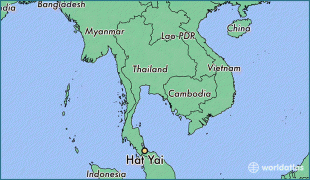
Thailand, historically known as Siam and officially the Kingdom of Thailand, is a country in Southeast Asia, located at the centre of the Indochinese Peninsula, spanning 513120 km2, with a population of almost 70 million. The country is bordered to the north by Myanmar and Laos, to the east by Laos and Cambodia, to the south by the Gulf of Thailand and Malaysia, and to the west by the Andaman Sea and the extremity of Myanmar. Thailand also shares maritime borders with Vietnam to the southeast, and Indonesia and India to the southwest. Bangkok is the nation's capital and largest city.
Tai peoples migrated from southwestern China to mainland Southeast Asia from the 11th century. Indianised kingdoms such as the Mon, Khmer Empire and Malay states ruled the region, competing with Thai states such as the Kingdoms of Ngoenyang, Sukhothai, Lan Na and Ayutthaya, which also rivalled each other. European contact began in 1511 with a Portuguese diplomatic mission to Ayutthaya, which became a regional power by the end of the 15th century. Ayutthaya reached its peak during the 18th century, until it was destroyed in the Burmese–Siamese War. Taksin quickly reunified the fragmented territory and established the short-lived Thonburi Kingdom. He was succeeded in 1782 by Buddha Yodfa Chulaloke, the first monarch of the current Chakri dynasty. Throughout the era of Western imperialism in Asia, Siam remained the only nation in the region to avoid colonization by foreign powers, although it was often forced to make territorial, trade and legal concessions in unequal treaties. The Siamese system of government was centralised and transformed into a modern unitary absolute monarchy in the reign of Chulalongkorn. In World War I, Siam sided with the Allies, a political decision made in order to amend the unequal treaties. Following a bloodless revolution in 1932, it became a constitutional monarchy and changed its official name to Thailand, becoming an ally of Japan in World War II. In the late 1950s, a military coup under Field Marshal Sarit Thanarat revived the monarchy's historically influential role in politics. Thailand became a major ally of the United States, and played an anti-communist role in the region as a member of the failed SEATO, but from 1975 sought to improve relations with Communist China and Thailand's neighbours.