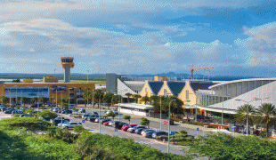
Curaçao International Airport (Hato International Airport)
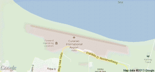
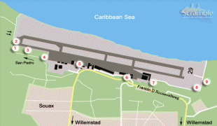
Curaçao International Airport, (Aeropuerto Internashonal Hato, Hato Internationale Luchthaven) also known as Hato International Airport (formerly Dr. Albert Plesman International Airport), is the only airport for the island of Curaçao. The airport is located on the north coast of Curaçao, 12 km from the capital Willemstad. Curaçao International Airport services flights from the Caribbean region, South America, North America and Europe and has the third longest commercial runway in the Caribbean region after Rafael Hernández Airport in Puerto Rico and Pointe-à-Pitre International Airport in Guadeloupe. The airport serves as a main base for Divi Divi Air, Jetair Caribbean as well as EZAir; it formerly served as a main base for ALM, KLM, DCA, DAE and Insel Air.
Located on the Dutch Caribbean island of Curaçao, the airport connects Europe, the Americas and the Caribbean. Curaçao International Airport is served by several airlines. It has one of the longest runways in the Caribbean, accommodating up to a Boeing 747. In the early fall of 2014, Curaçao International Airport opened a new General Aviation Center offering premier service in a separate building with a private entrance and exit and special amenities.
The airport was initially called Hato Airport, namesake to the nearby town of Hato. On Tuesday, 5 January 1954, the airport was renamed Dr. Albert Plesman airport. Plesman, director of the Royal Dutch Airlines for the Netherlands and Colonies, had died a few days earlier. Often it was spoken of Aeropuerto Plesman or Plesman Airport, unofficially also the name Hato remained in use till this day. Nowadays the official name is Curaçao International Airport. It will be unnecessary to set out in detail, of which it is of paramount importance, that the Dutch aviation industry gets a firm footing in the vicinity of the Caribbean sea, where air traffic is now becoming more and more a factor of economic significance.' - Albert Plesman'' With the above argument in March 1934 Albert Plesman, director of KLM, hoped to receive financial support from the Comité Vliegtocht Nederland-Indië. It was a new plan to head to the West. In the 1920s it started to interest itself in the Caribbean region. Curaçao was developing itself in a beneficial way due to the presence of the oil refinery and a growing number of people were starting to choose the region with the purpose of vacationing. Aviation companies were paying close attention to these developments and were researching if it was possible to create a connection between the United States, Curaçao and South America. The West Indische Gouvernement constructed a runway at the Hato plantation in Curaçao,
On 22 December 1934 the Snip plane arrived in Curaçao after an 8th day during trip with the route Amsterdam-Marseille-Alicante-Casablanca-Porto Praia-Paramaribo-La Guaria-Curaçao.
Hato was one of the most important and busiest airports in the Caribbean during the Second World War. The airfield was used by the US Air Force for patrols against submarines.
During the 1960s the 'Bestuurscollege' commissioned Netherlands Airport Consultants B.V. (NACO) to design a Master plan for the airport. This assignment was in connection with the expected arrival of the Boeing 747. The 'Jumbo' first flew on 9 February 1969.
Curaçao International Airport N.V. (Curinta) was founded in 1977 and operated the Airport until 2013. Its predecessor was the 'Luchthavenbedrijf', which was a department of the Government of Curaçao.
| IATA Code | CUR | ICAO Code | TNCC | FAA Code | |
|---|---|---|---|---|---|
| Telephone | Fax | ||||
| Home page | Hyperlink |
Map - Curaçao International Airport (Hato International Airport)
Map


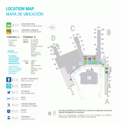
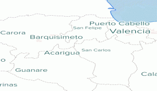
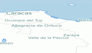
Country - Curaçao
 |
 |
Curaçao was formerly part of the Curaçao and Dependencies colony from 1815 to 1954 and later the Netherlands Antilles from 1954 to 2010, as Island Territory of Curaçao (Eilandgebied Curaçao, Teritorio Insular di Kòrsou), and is now formally called the Country of Curaçao. It includes the main island of Curaçao and the much smaller, uninhabited island of Klein Curaçao ("Little Curaçao"). Curaçao has a population of 158,665 (January 2019 est.), with an area of 444 km2; its capital is Willemstad.
Currency / Language
| ISO | Currency | Symbol | Significant figures |
|---|---|---|---|
| ANG | Netherlands Antillean guilder | Æ’ | 2 |
| ISO | Language |
|---|---|
| NL | Dutch language |