Herat Province (Herāt)
The province of Herat shares a border with Iran in the west and Turkmenistan in the north, making it an important trading region. The Trans-Afghanistan Pipeline (TAPI) is expected to pass through Herat from Turkmenistan to Pakistan and India in the south. The province has two airports, one is the Herat International Airport in the capital of Herat and the other is at the Sabzwar Air Base, which is one of the largest military bases in Afghanistan. The Salma Dam which is fed by the Hari River is also located in this province.
The region of Herat was historically part of Greater Khorasan, which was successively controlled by the Tahirids followed by the Saffarids, Samanids, Ghaznavids, Ghurids, Ilkhanates, Timurids, Safavids, Hotakis, Afsharids, Durranis, Qajarids until it became part of the modern state of Afghanistan. During the 19th century, the British arrived from southern Afghanistan as part of the "Great Game" and backed up the Afghans during one Persian siege and one capture of the city, the former in 1838, and the latter in 1856 in order to prevent Persian or Russian influence reaching deeper in South Asia, and also, more importantly, Britain's colony in India as part of the Great Game. The situation in province then remained quiet and uneventful until the 1979 Soviet invasion of Afghanistan.
The province saw a number of battles during the 1980s Soviet war, and remained an active area of guerrilla warfare throughout, with local mujahideen commander Ismail Khan leading resistance against the Soviet-backed Afghan government. This continued until the Soviet Union withdrew all its forces in 1989.
When the Soviets withdrew from Afghanistan, Ismail Khan became the governor of the province, a position he retained until the Taliban forces from the south took control of the province in 1995. Following the ousting of the Taliban and establishment of the Karzai administration, led by Hamid Karzai, Ismail Khan once again became governor of Herat.
Ismail Khan become a figure of controversy when the media began reporting that he was attempting to restrict freedom of the people, and that he was becoming more of an independent ruler as a warlord. He lost a son Mirwais Sadiq in 2004 during a fight with forces of other warlords. In response to this, the central government began expanding into the province with the newly trained Afghan National Security Forces (ANFS). Ismail Khan was ordered to leave his post to become a minister and live in Kabul.
After 2005, the International Security Assistance Force (ISAF) established presence in the area to help assist the Afghan government. It is led by Italy. A multi-national Provincial Reconstruction Team (PRT) was also established to help the local population of the province. The United States established a consulate in Herat, trained Afghan security forces, built schools, and clinics.
Herat was one of the first seven areas that transitioned security responsibility from NATO to Afghanistan. On 21 July 2011, Afghan security forces assumed lead security responsibility from NATO. On the occasion, Minister of Defence Wardak told the audience, "this is our national responsibility to take over our security and defend our country."
Map - Herat Province (Herāt)
Map
Country - Afghanistan
 |
 |
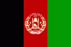
| Flag of Afghanistan | |
Human habitation in Afghanistan dates back to the Middle Paleolithic era, and the country's strategic location along the historic Silk Road has led it to being described, picturesquely, as the ‘roundabout of the ancient world’. Popularly referred to as the graveyard of empires, the land has historically been home to various peoples and has witnessed numerous military campaigns, including those by the Persians, Alexander the Great, the Maurya Empire, Arab Muslims, the Mongols, the British, the Soviet Union, and most recently by a US-led coalition. Afghanistan also served as the source from which the Greco-Bactrians and the Mughals, amongst others, rose to form major empires. The various conquests and periods in both the Iranian and Indian cultural spheres made the area a center for Zoroastrianism, Buddhism, Hinduism, and later Islam throughout history.
Currency / Language
| ISO | Currency | Symbol | Significant figures |
|---|---|---|---|
| AFN | Afghan afghani | Ø‹ | 2 |
| ISO | Language |
|---|---|
| PS | Pashto language |
| FA | Persian language |
| TK | Turkmen language |
| UZ | Uzbek language |


