Map - Herrera Province (Provincia de Herrera)

Herrera Province (Provincia de Herrera)
Herrera is a province in Panama. Named after General Tomás Herrera, the province was founded on January 18, 1915 from a division of the Los Santos province. The capital city of Herrera is Chitré, which is located near the province's coastline. Herrera is bordered on the north by the provinces of Veraguas and Coclé, on the south by the province of Los Santos, on the east by Golfo de Parita and the province of Los Santos, and on the west by the province of Veraguas.

After gaining independence from Spain in 1821, the isthmus of Panama was divided into two provinces, Panamá and Veraguas. The province Panamá consisted of the districts of Natá, Portobelo, Panama and Darién. At the time, the location now occupied by the city of Chitré was inhabited by a small population of indigenous persons, near La Villa de Los Santos and was governed from Natá. It later came under the control of the Los Santos government. The province of Herrera was created in 1854 and eliminated in 1860. 55 years later, in 1915 the province was created again by the president of Panama Dr. Belisario Porras.

Chitré was founded on October 19, 1848 by Ventura Solís, Matías Rodríguez, José Ríos, José María Benavidez, Ildelfonso Pérez, Blas Tello, Eugenio Barrera, José Burgos y Carlos Rodríguez. Chitré, however, was included in the province of Los Santos. It was not until 1915 under the Porras administration that Chitré became a part of Herrera and was made the province's capital.
 
Map - Herrera Province (Provincia de Herrera)
Map
Openstreetmap - Map - Herrera Province
Openstreetmap
Map - Herrera Province - Esri.WorldImagery
Esri.WorldImagery
Map - Herrera Province - Esri.WorldStreetMap
Esri.WorldStreetMap
Map - Herrera Province - OpenStreetMap.Mapnik
OpenStreetMap.Mapnik
Map - Herrera Province - OpenStreetMap.HOT
OpenStreetMap.HOT
Map - Herrera Province - CartoDB.Positron
CartoDB.Positron
Map - Herrera Province - CartoDB.Voyager
CartoDB.Voyager
Map - Herrera Province - OpenMapSurfer.Roads
OpenMapSurfer.Roads
Map - Herrera Province - Esri.WorldTopoMap
Esri.WorldTopoMap
Map - Herrera Province - Stamen.TonerLite
Stamen.TonerLite
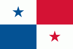
Country - Panama
Flag of Panama
Panama (, ; Panamá ), officially the Republic of Panama (República de Panamá), is a transcontinental country spanning the southern part of North America and the northern part of South America. It is bordered by Costa Rica to the west, Colombia to the southeast, the Caribbean Sea to the north, and the Pacific Ocean to the south. Its capital and largest city is Panama City, whose metropolitan area is home to nearly half the country's million people.

Panama was inhabited by indigenous tribes before Spanish colonists arrived in the 16th century. It broke away from Spain in 1821 and joined the Republic of Gran Colombia, a union of Nueva Granada, Ecuador, and Venezuela. After Gran Colombia dissolved in 1831, Panama and Nueva Granada eventually became the Republic of Colombia. With the backing of the United States, Panama seceded from Colombia in 1903, allowing the construction of the Panama Canal to be completed by the United States Army Corps of Engineers between 1904 and 1914. The 1977 Torrijos–Carter Treaties agreed to transfer the canal from the United States to Panama on December 31, 1999. The surrounding territory was first returned in 1979.
Currency / Language  
ISO Currency Symbol Significant figures
PAB Panamanian balboa B/ 2
USD United States dollar $ 2
Neighbourhood - Country  
  •  Costa rica 
  •  Colombia