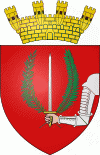
Il-Birgu
 |
 |
Birgu is a very old locality with its origins reaching back to medieval times. Prior to the establishment of Valletta as capital and main city of Malta, military powers that wanted to rule the Maltese islands would need to obtain control of Birgu due to its significant position in the Grand Harbour. In fact, it served as the base of the Order of Saint John and de facto capital city of Malta from 1530 to 1571. Birgu is well known for its vital role in the Great Siege of Malta of 1565.
In the early 20th century, Birgu had a population of over 6000 people. Over the years this decreased, and the population stood at 2,629 in March 2014. The local population speaks the Cottonera dialect, which is, however, most limited in Birgu.
Phoenicians, Greeks, Romans, Byzantines, Arabs, Normans, the Angevines, the Aragonese and the Order of Saint John all contributed to the development of Birgu.
In the Middle Ages, the islands' communal organisation in this period pitted the Mdina town-council, or Universitas, against the independent entity centred around the Castrum Maris. Many inhabitants of Birgu, and the neighbouring villages argued that they were not liable to pay taxes to the Mdina town-council, as they fell within Castrum Maris jurisdiction. For example, this was the case with the inhabitants of Żejtun, who refused to pay the taxes due to the Mdina council in 1473, even if as late as 1494 they were expected to take refuge in Mdina, rather than Birgu.
After being driven out of Rhodes by the Ottoman Empire, the Order of Saint John were granted Malta as their new home. In 1526, the Order sent a commission made up of eight knights to Malta, representing each of the langues. They described Birgu as a small defenceless town with old houses in poor condition. When they arrived in 1530, they decided to make Birgu the capital city of Malta, since the former capital, Mdina, was inland and did not suit their naval requirements.
The city was fortified in the 1530s and strengthened in the 1550s in preparation for an attack by the Ottoman Empire. This included the construction of the Castle of St Angelo, a large fortification separated from the city by a narrow channel, instead of the ancient Castrum Maris. The castle was connected to the city by means of a drawbridge.
Birgu was the site of major battles between the Knights and the Ottoman Empire during the Great Siege of Malta in 1565. After four months of successful defence by the Knights, the city was almost captured by the Ottoman army in August, but was recaptured by the Knights under Grand Master Jean Parisot de Valette. Reinforcements from Sicily arrived a month later, and the siege was abandoned by the Ottomans. After this, a new capital city was built on Mount Sceberras, bearing the name Valletta. In 1571, the Knights transferred their convent and seat to the new capital and Birgu lost some of its importance. Despite this, after the Siege, Birgu was given the title Città Vittoriosa, Italian for "victorious city".
After the taking of Malta by Napoleon in 1798, French forces were garrisoned in the city. Soon after the Maltese rebelled and the Grand Harbour area was blockaded by Maltese rebels aided by Britain, Portugal and Naples. The French eventually capitulated in September 1800, and Malta became a British protectorate. The Royal Navy's Mediterranean Fleet established its base in Birgu, and British forces remained stationed in Birgu until 1979.
In 1806, Birgu's gunpowder magazine exploded, killing over 200 people.
Map - Il-Birgu
Map


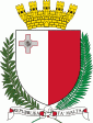
Country - Malta
 |
 |
| Flag of Malta | |
Malta has been inhabited since approximately 5900 BC. Its location in the centre of the Mediterranean has historically given it great strategic importance as a naval base, with a succession of powers having contested and ruled the islands, including the Phoenicians and Carthaginians, Romans, Greeks, Arabs, Normans, Aragonese, Knights of St. John, French, and British, amongst others.
Currency / Language
| ISO | Currency | Symbol | Significant figures |
|---|---|---|---|
| EUR | Euro | € | 2 |
| ISO | Language |
|---|---|
| EN | English language |
| MT | Maltese language |
