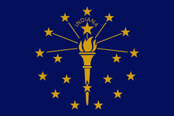
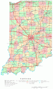
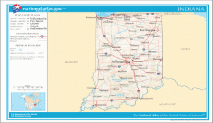
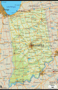
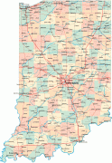
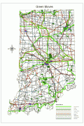
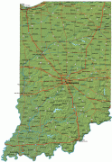
Indiana
 |
 |
Various indigenous peoples inhabited what would become Indiana for thousands of years, some of whom the U.S. government expelled between 1800 and 1836. Indiana received its name because the state was largely possessed by native tribes even after it was granted statehood. Since then, settlement patterns in Indiana have reflected regional cultural segmentation present in the Eastern United States; the state's northernmost tier was settled primarily by people from New England and New York, Central Indiana by migrants from the Mid-Atlantic states and adjacent Ohio, and Southern Indiana by settlers from the Upland South, particularly Kentucky and Tennessee.
Indiana has a diverse economy with a gross state product of $352.62billion in 2021. It has several metropolitan areas with populations greater than 100,000 and a number of smaller cities and towns. Indiana is home to professional sports teams, including the NFL's Indianapolis Colts and the NBA's Indiana Pacers. The state also hosts several notable competitive events, such as the Indianapolis 500, held at Indianapolis Motor Speedway.
Indiana's name means "Land of the Indians", or simply "Indian Land". It also stems from Indiana's territorial history. On May 7, 1800, the United States Congress passed legislation to divide the Northwest Territory into two areas and named the western section the Indiana Territory. In 1816, when Congress passed an Enabling Act to begin the process of establishing statehood for Indiana, a part of this territorial land became the geographic area for the new state.
Formal use of the word Indiana dates from 1768, when a Philadelphia-based trading company gave its land claim in present-day West Virginia the name "Indiana" in honor of its previous owners, the Iroquois. Later, ownership of the claim was transferred to the Indiana Land Company, the first recorded use of the word Indiana. But the Virginia colony argued that it was the rightful owner of the land because it fell within its geographic boundaries. The U.S. Supreme Court denied the land company's right to the claim in 1798.
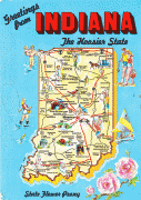
A native or resident of Indiana is known as a Hoosier. The etymology of this word is disputed, but the leading theory, advanced by the Indiana Historical Bureau and the Indiana Historical Society, has its origin in Virginia, the Carolinas, and Tennessee (the Upland South) as a term for a backwoodsman, a rough countryman, or a country bumpkin.
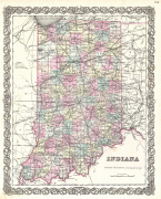
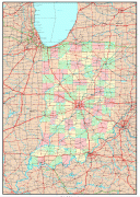
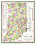
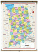
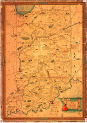
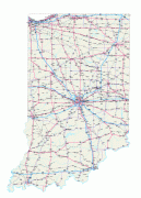
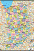
Map - Indiana
Map


Country - United_States
 |
 |
| Flag of the United States | |
Indigenous peoples have inhabited the Americas for thousands of years. Beginning in 1607, British colonization led to the establishment of the Thirteen Colonies in what is now the Eastern United States. They quarreled with the British Crown over taxation and political representation, leading to the American Revolution and proceeding Revolutionary War. The United States declared independence on July 4, 1776, becoming the first nation-state founded on Enlightenment principles of unalienable natural rights, consent of the governed, and liberal democracy. The country began expanding across North America, spanning the continent by 1848. Sectional division surrounding slavery in the Southern United States led to the secession of the Confederate States of America, which fought the remaining states of the Union during the American Civil War (1861–1865). With the Union's victory and preservation, slavery was abolished nationally by the Thirteenth Amendment.
Currency / Language
| ISO | Currency | Symbol | Significant figures |
|---|---|---|---|
| USD | United States dollar | $ | 2 |
| ISO | Language |
|---|---|
| EN | English language |
| FR | French language |
| ES | Spanish language |


