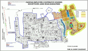
Islamabad
Islamabad is the capital city of Pakistan. It is the country's ninth-most populous city, with a population of over 1.2 million people, and is federally administered by the Pakistani government as part of the Islamabad Capital Territory. Built as a planned city in the 1960s, it replaced Rawalpindi as Pakistan's national capital. The city is notable for its high standards of living, safety, cleanliness, and abundant greenery.
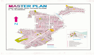
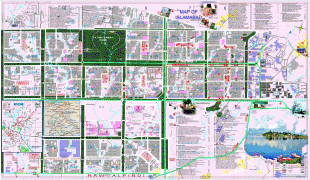
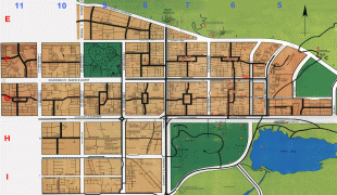
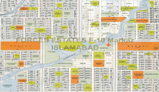
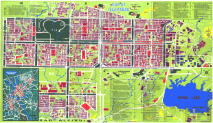
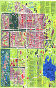
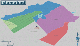
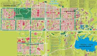
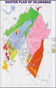
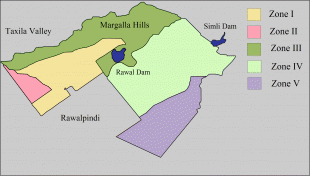
Greek architect Constantinos Apostolou Doxiadis developed Islamabad's master plan, in which he divided it into eight zones; administrative, diplomatic enclave, residential areas, educational and industrial sectors, commercial areas, as well as rural and green areas administered by the Islamabad Metropolitan Corporation with support from the Capital Development Authority. Islamabad is known for the presence of several parks and forests, including the Margalla Hills National Park and the Shakarparian. It is home to several landmarks, including the country's flagship Faisal Mosque, which is the world's fifth-largest mosque. Other prominent landmarks include the Pakistan Monument and Democracy Square.
Rated as Gamma + by the Globalization and World Cities Research Network, Islamabad has the highest cost of living in Pakistan. The city's populace is dominated by both middle and upper-middle class citizens.
Islamabad is home to twenty universities, including Bahria University, Quaid-e-Azam University, PIEAS, COMSATS University, and NUST. It is also rated as one of the safest cities in Pakistan, and has an expansive RFID-enabled surveillance system with almost 2000 active CCTV cameras.
The name Islamabad means City of Islam. It is derived from two words: Islam and abad. Islam refers to the religion of Islam, Pakistan's state religion, and -abad is a Persian suffix meaning cultivated place, indicating an inhabited place or city. According to a history book by Muhammad Ismail Zabeeh, a school teacher from Arifwala known as Qazi Abdur Rehman Amritsari proposed the name of the city.
Occasionally in writing, Islamabad is colloquially abbreviated ISB. Such usage originated in SMS language, in part due to the IATA location identifier for the Islamabad International Airport.
Map - Islamabad
Map


Country - Pakistan
 |
 |
| Flag of Pakistan | |
Pakistan is the site of several ancient cultures, including the 8,500-year-old Neolithic site of Mehrgarh in Balochistan, the Indus Valley civilisation of the Bronze Age, the most extensive of the civilisations of the Afro-Eurasia, and the ancient Gandhara civilization. The region that comprises the modern state of Pakistan was the realm of multiple empires and dynasties, including the Achaemenid; briefly that of Alexander the Great; the Seleucid, the Maurya, the Kushan, the Gupta; the Umayyad Caliphate in its southern regions, the Hindu Shahis, the Ghaznavids, the Delhi Sultanate, the Mughals, the Durranis, the Omani Empire, the Sikh Empire, British East India Company rule, and most recently, the British Indian Empire from 1858 to 1947.
Currency / Language
| ISO | Currency | Symbol | Significant figures |
|---|---|---|---|
| PKR | Pakistani rupee | ₨ | 2 |
| ISO | Language |
|---|---|
| EN | English language |
| PA | Panjabi language |
| PS | Pashto language |
| SD | Sindhi language |
| UR | Urdu |