Jalal-Abad Province (Jalal-Abad oblast)
 |
Jalal-Abad Region covers 32418 km2 (16.2% of total country's area) in central-western Kyrgyzstan.
The southern edge of the region is part of the Ferghana Valley. The rest of the region is mountainous. M41, the main north-south highway from Bishkek to Osh, takes a very crooked route down the center of the region. Another road follows the south border almost to the western tip and then turns northeast up the Chatkal valley to Kyzyl-Adyr in Talas Region. Another road (closed in winter and requiring a jeep from the Ferghana range to Kazarman) goes east to Kazarman and Naryn.
An integral part of the country's power system is Toktogul hydroelectric power station, which supplies electricity and water to both Kyrgyzstan and neighboring countries.
Map - Jalal-Abad Province (Jalal-Abad oblast)
Map


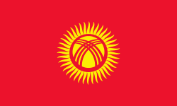
Country - Kyrgyzstan
 |
 |
| Flag of Kyrgyzstan | |
Ethnic Kyrgyz make up the majority of the country's 6.6 million people, followed by significant minorities of Uzbeks and Russians. The Kyrgyz language is closely related to other Turkic languages.
Currency / Language
| ISO | Currency | Symbol | Significant figures |
|---|---|---|---|
| KGS | Kyrgyzstani som | Ñ | 2 |
| ISO | Language |
|---|---|
| KY | Kirghiz language |
| RU | Russian language |
| UZ | Uzbek language |
